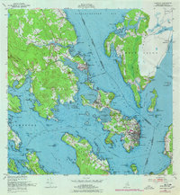
1949 Map of Eastport
USGS Topo · Published 1978About this map
Eastport and the surrounding islands define this intricate coastal landscape where the United States and Canada border runs through the deep waters of Friar Roads and Passamaquoddy Bay. Based on 1949 field checks, the map captures a period of active maritime and rail infrastructure, featuring the Maine Central railroad reaching into the town of Perry and terminating at the waterfront. The Pleasant Point Indian Reservation sits on the narrow neck of land between Gleason Cove and the mainland, serving as a critical cultural and geographical anchor.
Find a feature on this map
119 named features on this map. Tap any name to fly to it.
Don’t see what you’re looking for? This feature index may not catch every label — zoom into the map to look around manually.
Map Details
Editions of this 1949 Eastport Map
4 editions found

Other maps of this area

1907 · Eastport
USGS Topo · 1:48,000

1908 · Eastport
USGS Topo · 1:62,500

1929 · Robbinston
USGS Topo · 1:48,000

1931 · Robbinston
USGS Topo · 1:62,500

1943 · Eastport
USGS Topo · 1:62,500

1945 · Eastport
USGS Topo · 1:62,500

1949 · Robbinston
USGS Topo · 1:24,000

1949 · Whiting
USGS Topo · 1:24,000

1949 · Pembroke
USGS Topo · 1:24,000

1949 · Red Beach
USGS Topo · 1:24,000