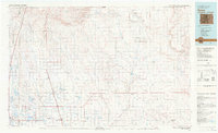
1982 Map of Eaton
USGS Topo · Published 1982About this map
The High Plains of Northern Colorado and Southern Wyoming meet along the dramatic escarpment of Chalk Bluffs, revealing a landscape defined by industrial energy and agricultural persistence in the early 1980s. The western portion of the map showcases the intensive irrigation network of the Cache la Poudre River valley, where settlements like Eaton and Ault are linked by the Union Pacific and Colorado and Southern railroads. Moving eastward, the terrain opens into the wide drainage of Crow Creek, where the Black Hollow Oil Field and Keota Oil Field signify the region's extraction history. Local researchers can trace the remnants of transit history along the Old RR Grade and Old Grade, while genealogists can locate smaller outposts like Briggsdale, Hereford, and Keota, many of which served as vital hubs for homesteaders and ranchers across Seven Cross Hill.
Find a feature on this map
57 named features on this map. Tap any name to fly to it.
Don’t see what you’re looking for? This feature index may not catch every label — zoom into the map to look around manually.
Map Details
Editions of this 1982 Eaton Map
2 editions found
Other maps of this area

1902 · Greeley
USGS Topo · 1:125,000

1905 · Sherman
USGS Topo · 1:125,000

1906 · Loveland
USGS Topo · 1:62,500

1906 · Fort Collins
USGS Topo · 1:62,500

1907 · Livermore
USGS Topo · 1:125,000

1908 · Loveland
USGS Topo · 1:62,500

1908 · Fort Collins
USGS Topo · 1:62,500

1908 · Eaton
USGS Topo · 1:125,000

1909 · Livermore
USGS Topo · 1:125,000

1910 · Eaton
USGS Topo · 1:125,000