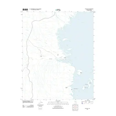
2012 Map of Echo Bay
USGS Topo · Published 2012About this map
Lake Mead and its Overton Arm define this desert landscape where water meets the arid terrain of Clark County. The settlement at Echo Bay serves as a focal point for the region, supported by infrastructure including the Echo Bay Airport and Echo Bay Rd. The topography is marked by several dry washes that drain toward the reservoir, such as Calico Wash, Rogers Wash, and Echo Wash.
Find a feature on this map
26 named features on this map. Tap any name to fly to it.
Don’t see what you’re looking for? This feature index may not catch every label — zoom into the map to look around manually.
Map Details
Editions of this 2012 Echo Bay Map
This is the sole edition of this map. No revisions or reprints were ever made.
Other maps of this area

1886 · Saint Thomas
USGS Topo · 1:250,000

1893 · Saint Thomas
USGS Topo · 1:250,000

1926 · Bonelli
USGS Topo · 1:96,000

1926 · Boulder Canyon
USGS Topo · 1:96,000

1953 · Muddy Peak
USGS Topo · 1:62,500

1953 · Overton Beach
USGS Topo · 1:62,500

1953 · Hoover Dam
USGS Topo · 1:62,500

1953 · Virgin Basin
USGS Topo · 1:62,500

1954 · Las Vegas
USGS Topo · 1:250,000

1957 · Las Vegas
USGS Topo · 1:250,000