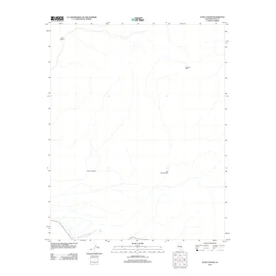
2012 Map of Echo Canyon
USGS Topo · Published 2012About this map
Death Valley National Park reveals a landscape defined by extreme relief and sparse water sources in this 2012 survey. The drainage of Furnace Cr Wash cuts through the southwestern corner, providing a vital geographic corridor near Navel Spring. High points like Schwaub Peak overlook deep geological depressions, including the notable Echo Canyon and the natural basin of the Red Amphitheater. The placement of Hole in the Wall suggests the intricate terrain that defines this arid region, illustrating the complex network of washes and peaks that hikers and geologists navigate within the park's protected boundaries.
Find a feature on this map
7 named features on this map. Tap any name to fly to it.
Don’t see what you’re looking for? This feature index may not catch every label — zoom into the map to look around manually.
Map Details
Editions of this 2012 Echo Canyon Map
This is the sole edition of this map. No revisions or reprints were ever made.
Other maps of this area

1908 · Furnace Creek
USGS Topo · 1:250,000

1910 · Furnace Creek
USGS Topo · 1:250,000
1942 · Bullfrog
USGS Topo · 1:125,000

1948 · Death Valley
USGS Topo · 1:250,000
1952 · Chloride Cliff
USGS Topo · 1:50,000
1952 · Furnace Creek
USGS Topo · 1:62,500
1952 · Ryan
USGS Topo · 1:62,500
1952 · Big Dune
USGS Topo · 1:62,500

1954 · Death Valley
USGS Topo · 1:250,000

1956 · Death Valley
USGS Topo · 1:250,000