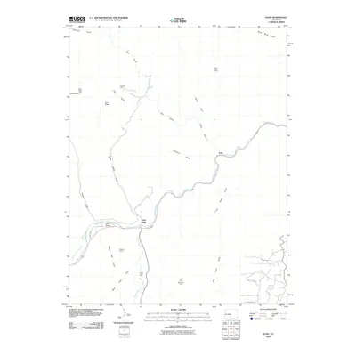
2010 Map of Echo
USGS Topo · Published 2010About this map
The Arkansas River carves a deep path through this Colorado landscape, defining the primary transit and settlement corridor for Echo and the junction at Texas Creek. This 2010 survey illustrates a region where mining and quarrying have long influenced the local economy, visible through operations like the Zingheim Quarry and the Texas Creek Mine. The presence of several named claims, including the Navajo Claim and Big Emma Claim, alongside the evocative Misery Mine Group in the northern canyonlands, points to the area's history of mineral exploration.
Find a feature on this map
32 named features on this map. Tap any name to fly to it.
Don’t see what you’re looking for? This feature index may not catch every label — zoom into the map to look around manually.
Map Details
Editions of this 2010 Echo Map
This is the sole edition of this map. No revisions or reprints were ever made.
Other maps of this area

1889 · Canon City
USGS Topo · 1:125,000

1892 · Canon City
USGS Topo · 1:125,000

1894 · Pikes Peak
USGS Topo · 1:125,000

1901 · Pikes Peak
USGS Topo · 1:125,000

1942 · Cover Mtn.
USGS Topo · 1:62,500

1948 · Cover Mtn.
USGS Topo · 1:62,500

1954 · Pueblo
USGS Topo · 1:250,000

1957 · Pueblo
USGS Topo · 1:250,000

1958 · Pueblo
USGS Topo · 1:250,000

1959 · Black Mountain
USGS Topo · 1:62,500