
1942 Map of Cover Mtn.
USGS Topo · Published 1972About this map
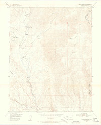
Stahl Ranch, Wann Ranch, and the Nash Ranch anchor the northern reaches of this landscape where Park, Teller, and Fremont counties meet. This 1942 survey illustrates a ranching and mining economy defined by the high-altitude terrain of the Bare Hills and the Colorado Feldspar Company Mine. Small rural institutions like the Wilson Creek Sch and Twelvemile Sch served families scattered across the drainages of Wilson Creek and Twelvemile Creek. The map documents a network of gulches and ridges, from Hole in the Rock Gulch to the prominent Cover Mtn, showing how early settlers adapted to the complex geography of High Park and Wilson Park. These named landmarks and family holdings provide a detailed look at the occupation of this part of the Colorado Front Range before modern development altered the land use.
Find a feature on this map
75 named features on this map. Tap any name to fly to it.
Don’t see what you’re looking for? This feature index may not catch every label — zoom into the map to look around manually.
Map Details
Editions of this 1942 Cover Mtn. Map
This is the sole edition of this map. No revisions or reprints were ever made.
Other maps of this area

1889 · Canon City
USGS Topo · 1:125,000

1892 · Canon City
USGS Topo · 1:125,000

1894 · Pikes Peak
USGS Topo · 1:125,000

1901 · Pikes Peak
USGS Topo · 1:125,000

1901 · Pikes Peak
USGS Topo · 1:62,500

1948 · Cover Mtn.
USGS Topo · 1:62,500

1951 · Cripple Creek South
USGS Topo · 1:24,000

1951 · Cripple Creek North
USGS Topo · 1:24,000
1954 · Cooper Mountain
USGS Topo · 1:24,000

1954 · Pueblo
USGS Topo · 1:250,000