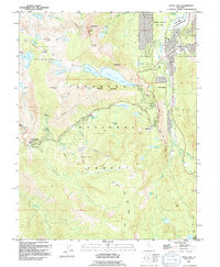
1992 Map of Echo Lake
USGS Topo · Published 1994About this map
The High Sierra landscape near the El Dorado Co line is defined by the sharp transition from the granite basins of the Desolation Wilderness to the developed alpine corridor of the South Fork American River. By the early 1990s, this area supported a mix of year-round settlements like Meyers and seasonal recreation hubs. The map detail highlights the engineering of the high country, including the Spillway connecting Upper Echo Lake and Lower Echo Lake, and the winding ascent of the Pacific Crest National Scenic Trail through the high passes.
Find a feature on this map
80 named features on this map. Tap any name to fly to it.
Don’t see what you’re looking for? This feature index may not catch every label — zoom into the map to look around manually.
Map Details
Editions of this 1992 Echo Lake Map
2 editions found
Other maps of this area

1889 · Pyramid Peak
USGS Topo · 1:125,000

1889 · Markleeville
USGS Topo · 1:125,000

1891 · Markleeville
USGS Topo · 1:125,000

1891 · Pyramid Peak
USGS Topo · 1:125,000

1893 · Markleeville
USGS Topo · 1:125,000

1895 · Pyramid Peak
USGS Topo · 1:125,000

1896 · Pyramid Peak
USGS Topo · 1:125,000

1947 · Sacramento
USGS Topo · 1:250,000

1948 · Walker Lake
USGS Topo · 1:250,000

1948 · Sacramento
USGS Topo · 1:250,000