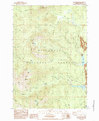
1984 Map of Echo Mountain
USGS Topo · Published 1985About this map
The Old Santiam Wagon Road cuts a historic path through the high Cascades, following the drainage of Hackleman Creek toward the eastern edge of the Willamette National Forest. This 1984 provisional survey documents a landscape defined by volcanic geography and early transit corridors, where the legacy of nineteenth-century pioneer travel meets mid-century forest management. High peaks such as Crescent Mountain and Echo Mountain overlook a complex watershed including the North and South Forks of the Santiam River system. The presence of the Fish Lake Work Center and Lost Prairie Campground highlights the area's transition into a recreational and administrative hub. To the east, the map captures the distinctive shoreline of Lava Lake and the northern tip of Clear Lake, areas where ancient lava flows disrupted drainage patterns to create the high-altitude basins seen today.
Find a feature on this map
38 named features on this map. Tap any name to fly to it.
Don’t see what you’re looking for? This feature index may not catch every label — zoom into the map to look around manually.
Map Details
Editions of this 1984 Echo Mountain Map
This is the sole edition of this map. No revisions or reprints were ever made.
Other maps of this area

1927 · Mt. Jefferson
USGS Topo · 1:125,000

1929 · Mill City
USGS Topo · 1:125,000

1929 · Three Sisters
USGS Topo · 1:125,000

1930 · Mt. Jefferson
USGS Topo · 1:125,000

1932 · Three Sisters
USGS Topo · 1:125,000

1934 · Mc Kenzie Bridge
USGS Topo · 1:96,000

1940 · Mc Kenzie Bridge
USGS Topo · 1:125,000

1953 · Salem
USGS Topo · 1:250,000

1954 · Salem
USGS Topo · 1:250,000

1955 · Echo Mountain
USGS Topo · 1:62,500