
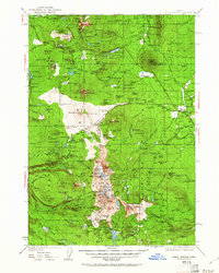
1929 Map of Three Sisters
USGS Topo · Published 1956About this map
The North Sister, Middle Sister, and South Sister anchor this volcanic landscape, surveyed in the late 1920s before modern road networks fully altered the high desert and mountain passes. The map documents an era of early fire suppression and range management, featuring isolated outposts like the Allingham Guard Station and the Black Butte Lookout. To the east, the settlement of Sisters and the historic Camp Polk area show the beginnings of community development near the Metolius Spring.
Find a feature on this map
192 named features on this map. Tap any name to fly to it.
Don’t see what you’re looking for? This feature index may not catch every label — zoom into the map to look around manually.
Map Details
Editions of this 1929 Three Sisters Map
2 editions found
Other maps of this area

1925 · Waldo Lake
USGS Topo · 1:125,000

1926 · Bend
USGS Topo · 1:125,000

1927 · Mt. Jefferson
USGS Topo · 1:125,000

1928 · Madras
USGS Topo · 1:125,000

1929 · Mill City
USGS Topo · 1:125,000

1929 · Bend
USGS Topo · 1:125,000

1930 · Maiden Peak
USGS Topo · 1:125,000

1930 · Mt. Jefferson
USGS Topo · 1:125,000

1931 · Madras
USGS Topo · 1:125,000

1931 · Newberry Crater
USGS Topo · 1:125,000