
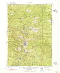
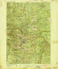
1926 Map of Bend
USGS Topo · Published 1963About this map
Bend serves as the primary hub of Central Oregon in this mid-1920s topography, showing a landscape defined by volcanic geology and the arrival of major irrigation and rail infrastructure. The Deschutes River and Crooked River slice deep canyons through the high desert, punctuated by numerous cataracts such as Steelhead Falls, Odin Falls, and Awbrey Falls. The engineering of the era is evident in the sprawling network of canals feeding into the Tumalo Reservoir and the presence of the Oregon Trunk Railway.
Find a feature on this map
67 named features on this map. Tap any name to fly to it.
Don’t see what you’re looking for? This feature index may not catch every label — zoom into the map to look around manually.
Map Details
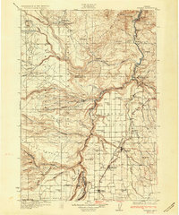
Editions of this 1926 Bend Map
This is the sole edition of this map. No revisions or reprints were ever made.
Other maps of this area
1927 · Mt. Jefferson
USGS Topo · 1:125,000

1928 · Madras
USGS Topo · 1:125,000

1929 · Bend
USGS Topo · 1:125,000

1929 · Three Sisters
USGS Topo · 1:125,000

1930 · Maiden Peak
USGS Topo · 1:125,000
1930 · Mt. Jefferson
USGS Topo · 1:125,000
1931 · Madras
USGS Topo · 1:125,000

1931 · Newberry Crater
USGS Topo · 1:125,000

1932 · Three Sisters
USGS Topo · 1:125,000

1934 · Maiden Peak
USGS Topo · 1:125,000