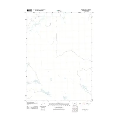
2012 Map of Ecoffey Lake
USGS Topo · Published 2012About this map
The Little White River meanders across the northern portion of this Bennett County landscape, its course punctuated by Emma Springs near the edge of the drainage. This high plains region is defined by a series of localized basins and small water bodies that dot the prairie, including the namesake Ecoffey Lake and nearby Posey Lake. The terrain transitions into a more hydrologically diverse area to the south, where West Lake, East Lake, and Robinson Lake cluster near the headwaters of Bear Cr. A sparse network of section-line roads, such as 296th St and Badger Rd, provides the primary access to this interior ranchland, illustrating the vast, open character of the South Dakota landscape at the start of the 21st century.
Find a feature on this map
14 named features on this map. Tap any name to fly to it.
Don’t see what you’re looking for? This feature index may not catch every label — zoom into the map to look around manually.
Map Details
Editions of this 2012 Ecoffey Lake Map
This is the sole edition of this map. No revisions or reprints were ever made.
Other maps of this area

1950 · Irwin
USGS Topo · 1:62,500

1951 · Irwin
USGS Topo · 1:62,500

1955 · Hot Springs
USGS Topo · 1:250,000

1955 · Alliance
USGS Topo · 1:250,000

1955 · Martin
USGS Topo · 1:250,000

1957 · Alliance
USGS Topo · 1:250,000

1957 · Valentine
USGS Topo · 1:250,000

1958 · Martin
USGS Topo · 1:250,000

1958 · Alliance
USGS Topo · 1:250,000

1959 · Valentine
USGS Topo · 1:250,000