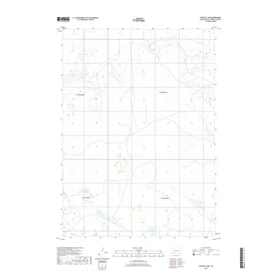
2017 Map of Ecoffey Lake
USGS Topo · Published 2017About this map
Ecoffey Lake and the winding course of the Little White River define this portion of Bennett County, South Dakota. The landscape is characterized by its high concentration of surface water features, including Emma Springs and a series of smaller basins like Robinson Lake, Posey Lake, and the adjacent West Lake and East Lake. This survey illustrates the intricate drainage patterns of the region, where the river system and isolated lake beds reflect the local topography and groundwater levels. The map provides a clear look at the undeveloped prairie environment and the water sources that have historically supported ranching and land use in this part of the state.
Find a feature on this map
11 named features on this map. Tap any name to fly to it.
Don’t see what you’re looking for? This feature index may not catch every label — zoom into the map to look around manually.
Map Details
Editions of this 2017 Ecoffey Lake Map
This is the sole edition of this map. No revisions or reprints were ever made.
Other maps of this area
1950 · Irwin
USGS Topo · 1:62,500
1951 · Irwin
USGS Topo · 1:62,500

1955 · Hot Springs
USGS Topo · 1:250,000

1955 · Alliance
USGS Topo · 1:250,000

1955 · Martin
USGS Topo · 1:250,000

1957 · Alliance
USGS Topo · 1:250,000

1957 · Valentine
USGS Topo · 1:250,000

1958 · Martin
USGS Topo · 1:250,000

1958 · Alliance
USGS Topo · 1:250,000

1959 · Valentine
USGS Topo · 1:250,000