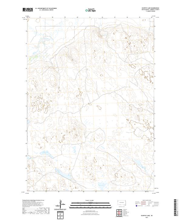
2021 Map of Ecoffey Lake
USGS Topo · Published 2021About this map
Little White River meanders across the northern portion of this Bennett County landscape, carving a wide valley through the plains of southern South Dakota. The area is defined by its intermittent water sources and the varied topography of the Great Plains, where high ridges separate the drainage of the river from the basin containing Ecoffey Lake. This map captures a rural expanse dominated by natural hydrology and public land survey divisions, including townships t36n r40w and t35n r39w. Seasonal wetlands and smaller bodies of water like Posey Lake, West Lake, and East Lake dot the southern terrain, while Emmo Springs provides a rare localized point of groundwater discharge to the north. The lack of concentrated settlements highlights the open, ranching-oriented character of the region during the early twenty-first century.
Find a feature on this map
10 named features on this map. Tap any name to fly to it.
Don’t see what you’re looking for? This feature index may not catch every label — zoom into the map to look around manually.
Map Details
Editions of this 2021 Ecoffey Lake Map
This is the sole edition of this map. No revisions or reprints were ever made.
Other maps of this area

1950 · Irwin
USGS Topo · 1:62,500

1951 · Irwin
USGS Topo · 1:62,500

1955 · Hot Springs
USGS Topo · 1:250,000

1955 · Alliance
USGS Topo · 1:250,000

1955 · Martin
USGS Topo · 1:250,000

1957 · Alliance
USGS Topo · 1:250,000

1957 · Valentine
USGS Topo · 1:250,000

1958 · Martin
USGS Topo · 1:250,000

1958 · Alliance
USGS Topo · 1:250,000

1959 · Valentine
USGS Topo · 1:250,000