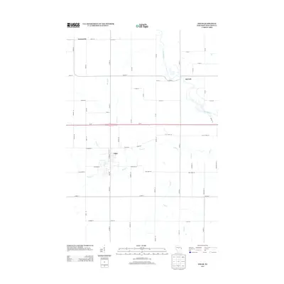
2013 Map of Edgar
USGS Topo · Published 2013About this map
The village of Edgar serves as the central hub of this Marathon County landscape, where the local street grid meets the rural road network of central Wisconsin. Situated south of the Wi-29 corridor, the town's development is closely tied to the surrounding waterways, most notably the winding path of Scotch Cr. To the north and east, the Big Rib River carves through the terrain near the settlement of Rib Falls, a significant local landmark that historically defined the area's geography. The map reveals a highly structured agricultural and residential grid, defined by routes such as Co HWY-H and Cardinal Ln. Smaller drainages like Pet Brook, Soda Cr, and Omar Cr thread between these farm roads, illustrating the intricate drainage patterns that support the region's dairy and timber heritage. Further north, the named locality of Poniatowski marks the northern extent of this surveyed area.
Find a feature on this map
55 named features on this map. Tap any name to fly to it.
Don’t see what you’re looking for? This feature index may not catch every label — zoom into the map to look around manually.
Map Details
Editions of this 2013 Edgar Map
This is the sole edition of this map. No revisions or reprints were ever made.
Other maps of this area

1902 · Marathon
USGS Topo · 1:125,000

1951 · Athens
USGS Topo · 1:48,000

1951 · Hamburg
USGS Topo · 1:48,000

1953 · Marathon
USGS Topo · 1:48,000

1953 · Stratford
USGS Topo · 1:48,000

1953 · Eau Claire
USGS Topo · 1:250,000

1953 · Rice Lake
USGS Topo · 1:250,000

1954 · Iron Mountain
USGS Topo · 1:250,000

1955 · Green Bay
USGS Topo · 1:250,000

1958 · Eau Claire
USGS Topo · 1:250,000