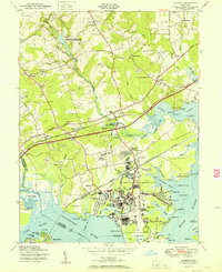
1951 Map of Edgewood
USGS Topo · Published 1951About this map
The Army Chemical Center and its surrounding infrastructure dominate the coastal plains of Harford County in the years following World War II. This 1949 field check reveals a landscape where military utility and early Maryland settlements coexist along the estuaries of the Bush River and Gunpowder River. The Pennsylvania Railroad and Baltimore and Ohio Railroad slice through the region, connecting industrial nodes like the Edgewood Plant to established communities such as Abingdon and Joppa.
Find a feature on this map
86 named features on this map. Tap any name to fly to it.
Don’t see what you’re looking for? This feature index may not catch every label — zoom into the map to look around manually.
Map Details
Editions of this 1951 Edgewood Map
2 editions found
Other maps of this area

1893 · Gunpowder
USGS Topo · 1:62,500

1898 · Tolchester
USGS Topo · 1:125,000

1900 · Havre De Grace
USGS Topo · 1:62,500

1900 · Betterton
USGS Topo · 1:62,500

1901 · Belair
USGS Topo · 1:62,500

1901 · Gunpowder
USGS Topo · 1:62,500

1903 · Tolchester
USGS Topo · 1:125,000

1908 · Tolchester
USGS Topo · 1:125,000

1941 · Gunpowder
USGS Topo · 1:62,500

1942 · Havre De Grace
USGS Topo · 1:62,500