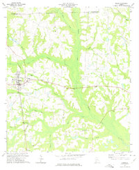
1973 Map of Edison
USGS Topo · Published 1975About this map
The agricultural hub of Edison anchors this southwest Georgia survey, showing the town's layout alongside the Seaboard Coast Line railroad. The landscape is defined by the broad, low-lying drainage of Pachitla Creek and its many tributaries, including Little Creek and Neals Creek. These waterways create a distinct pattern of wetlands and wooded corridors that separate the upland farms.
Find a feature on this map
33 named features on this map. Tap any name to fly to it.
Don’t see what you’re looking for? This feature index may not catch every label — zoom into the map to look around manually.
Map Details
Editions of this 1973 Edison Map
This is the sole edition of this map. No revisions or reprints were ever made.
Other maps of this area

1953 · Dothan
USGS Topo · 1:250,000

1954 · Dothan
USGS Topo · 1:250,000

1955 · Dothan
USGS Topo · 1:250,000
1973 · Morgan
USGS Topo · 1:24,000
1973 · Martins Crossroads
USGS Topo · 1:24,000
1973 · Bancroft
USGS Topo · 1:24,000
1973 · Doverel
USGS Topo · 1:24,000
1973 · Carnegie
USGS Topo · 1:24,000
1973 · Bluffton
USGS Topo · 1:24,000
1974 · Arlington
USGS Topo · 1:24,000