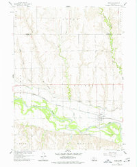
1958 Map of Edison
USGS Topo · Published 1977About this map
The village of Edison sits at the intersection of early transportation and irrigation infrastructure in southern Nebraska. Located along the Chicago Burlington And Quincy railroad line, the settlement is positioned just north of the Republican River, where the landscape is defined by a complex system of water management. The Cambridge Canal traverses the river valley, utilizing specialized engineering features like a Siphon and Flume to navigate the undulating terrain. North of the river, the township is carved by numerous seasonal drainages, including Big Antelope Creek and Turkey Creek, which flow toward the Republican River through the precincts of Union and Arapahoe. The map provides a detailed view of rural land divisions and family legacy markers such as the Edison Cem, reflecting the agricultural development of the Furnas County area during the mid-20th century.
Find a feature on this map
20 named features on this map. Tap any name to fly to it.
Don’t see what you’re looking for? This feature index may not catch every label — zoom into the map to look around manually.
Map Details
Editions of this 1958 Edison Map
2 editions found
Other maps of this area

1896 · Arapahoe
USGS Topo · 1:125,000

1898 · Arapahoe
USGS Topo · 1:125,000

1955 · Grand Island
USGS Topo · 1:250,000

1957 · Grand Island
USGS Topo · 1:250,000

1958 · Grand Island
USGS Topo · 1:250,000

1958 · Edison
USGS Topo · 1:24,000

1958 · Hollinger
USGS Topo · 1:24,000
1958 · Arapahoe
USGS Topo · 1:24,000
1958 · Hendley
USGS Topo · 1:24,000
1958 · Beaver City
USGS Topo · 1:24,000