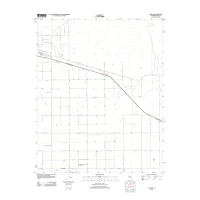
2012 Map of Edison
USGS Topo · Published 2012About this map
Edison Oil Field and the neighboring Mountain View Oil Field dominate this section of the San Joaquin Valley, where industrial petroleum extraction and large-scale agriculture converge. The settlement of Di Giorgio serves as a hub for the region's agricultural operations, flanked by worker housing at Camp Ten A, Camp Ten B, and Camp Eight. This landscape is defined by its grid of transit and utility corridors, including the Edison Hwy and a network of arterial roads like Comanche Dr and Tejon Hwy. The arid terrain is crossed by the ephemeral beds of Caliente Cr and Walker Basin Cr, while specialized facilities like the Di Giorgio Ranch Landing Strip Airport and local landmarks like the Rock Pile highlight the diverse land use of Kern County in the early 21st century.
Find a feature on this map
46 named features on this map. Tap any name to fly to it.
Don’t see what you’re looking for? This feature index may not catch every label — zoom into the map to look around manually.
Map Details
Editions of this 2012 Edison Map
This is the sole edition of this map. No revisions or reprints were ever made.
Other maps of this area

1906 · Bakersfield
USGS Topo · 1:62,500

1914 · Caliente
USGS Topo · 1:125,000

1929 · Bena
USGS Topo · 1:31,680

1929 · Fairfax School
USGS Topo · 1:31,680

1930 · Weed Patch
USGS Topo · 1:31,680

1930 · Bear Mountain
USGS Topo · 1:31,680

1930 · Arvin
USGS Topo · 1:31,680

1931 · Edison
USGS Topo · 1:31,680

1932 · Bena
USGS Topo · 1:31,680

1932 · Fairfax School
USGS Topo · 1:31,680