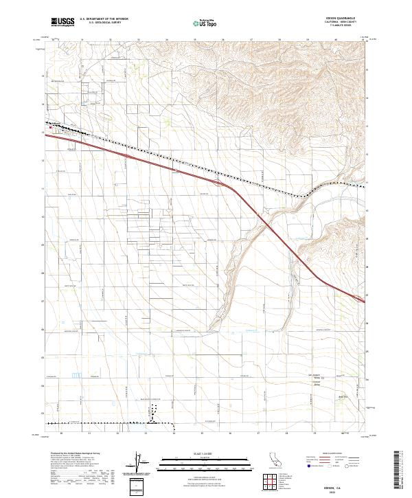
2022 Map of Edison
USGS Topo · Published 2022About this map
Edison anchors the northwest corner of this landscape, situated at the edge of the sprawling San Joaquin Valley agricultural region. The map illustrates a transition from the structured grid of the valley floor into the rising terrain of the east, where the Central Valley begins its ascent. Waterways like Walker Basin Cr and Caliente Cr wind through the topography, reflecting the drainage patterns vital to the local geography. Transport corridors define the movement through the area, with the Edison Hwy and Bena Rd cutting across the terrain toward the hills. This 2022 data also captures specific local landmarks such as the Rock Pile and industrial markers like Bear Mountain Winery Rd, providing a contemporary view of the intersection between Kern County's agricultural infrastructure and its natural landforms.
Find a feature on this map
47 named features on this map. Tap any name to fly to it.
Don’t see what you’re looking for? This feature index may not catch every label — zoom into the map to look around manually.
Map Details
Editions of this 2022 Edison Map
This is the sole edition of this map. No revisions or reprints were ever made.
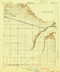
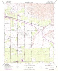
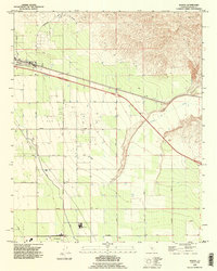
Historical Maps of Edison Through Time
5 maps found