
1950 Map of Edison
USGS Topo · Published 1950About this map
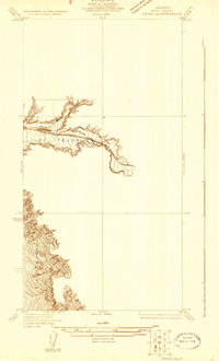
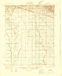
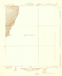
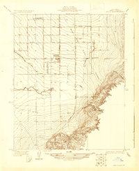
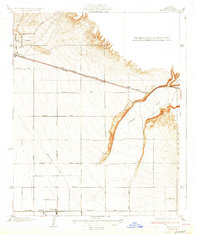
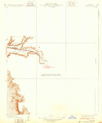
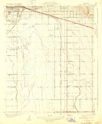
Edison and the surrounding Kern County agricultural lands are defined by a rigid grid of transit and utility corridors in this mid-century survey. The landscape is dominated by the Southern Pacific and the shared Southern Pacific and AT & SF rail lines, which facilitated the movement of goods from settlements like Di Giorgio and Sivert. The eastern portion of the map transitions into the rising terrain of El Tejon, where Caliente Creek cuts through the foothills. A sophisticated infrastructure of industrial development is evident through the prominent Towerline and Transmission Line features that parallel the north-south routes like Comanche Drive. The map captures a moment when the transition from a rail-based economy to an automotive one is visible along the Tehachapi Pacific Highway.
Find a feature on this map
25 named features on this map. Tap any name to fly to it.
Don’t see what you’re looking for? This feature index may not catch every label — zoom into the map to look around manually.
Map Details
Editions of this 1950 Edison Map
This is the sole edition of this map. No revisions or reprints were ever made.
Other maps of this area

1906 · Bakersfield
USGS Topo · 1:62,500

1914 · Caliente
USGS Topo · 1:125,000
1929 · Bena
USGS Topo · 1:31,680
1929 · Fairfax School
USGS Topo · 1:31,680

1930 · Weed Patch
USGS Topo · 1:31,680
1930 · Bear Mountain
USGS Topo · 1:31,680
1930 · Arvin
USGS Topo · 1:31,680
1931 · Edison
USGS Topo · 1:31,680
1932 · Bena
USGS Topo · 1:31,680
1932 · Fairfax School
USGS Topo · 1:31,680