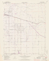
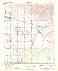
1954 Map of Edison
USGS Topo · Published 1976About this map
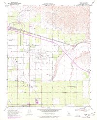
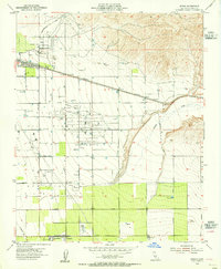
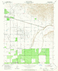
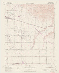
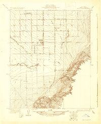
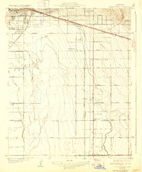
Edison and Di Giorgio serve as the primary hubs in this agricultural and industrial landscape of Kern County. The map captures a high degree of development driven by the local petroleum industry, dominated by the Edison Oil Field and the Racetrack Oil Field. These fields are marked by a dense network of derricks and infrastructure, including numerous oil sumps. The intersection of heavy transit and resource extraction is evident where the Southern Pacific and Atchison Topeka and Santa Fe railroads parallel each other through the center of the sheet. Further south, the map details worker settlements such as Camp 10 A, Camp 10 B, and Camp 8, alongside a notable Winery. The eastern edge is defined by the wash of Caliente Creek, showing the transition from the flat valley floor to the rising foothills.
Find a feature on this map
32 named features on this map. Tap any name to fly to it.
Don’t see what you’re looking for? This feature index may not catch every label — zoom into the map to look around manually.
Map Details
Editions of this 1954 Edison Map
6 editions found
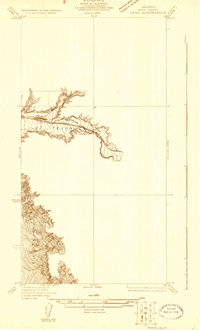
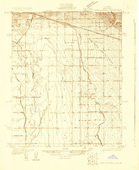
Other maps of this area

1906 · Bakersfield
USGS Topo · 1:62,500

1914 · Caliente
USGS Topo · 1:125,000
1929 · Bena
USGS Topo · 1:31,680
1929 · Fairfax School
USGS Topo · 1:31,680

1930 · Weed Patch
USGS Topo · 1:31,680
1930 · Bear Mountain
USGS Topo · 1:31,680
1930 · Arvin
USGS Topo · 1:31,680
1931 · Edison
USGS Topo · 1:31,680
1932 · Bena
USGS Topo · 1:31,680
1932 · Fairfax School
USGS Topo · 1:31,680