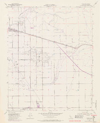
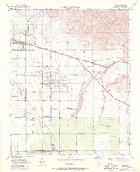
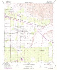
1954 Map of Edison
USGS Topo · Published 1970About this map
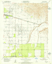
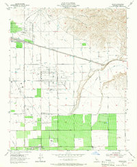
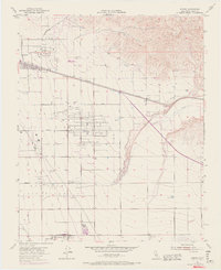
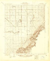
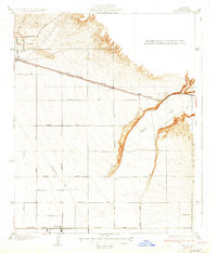
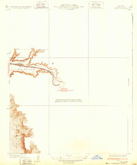
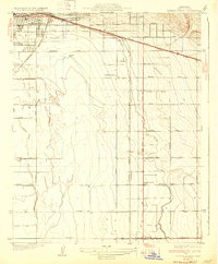
The Edison Oil Field and Mtn View Oil Field dominate this mid-century landscape of Kern County, where petroleum extraction and agricultural enterprise exist side-by-side. The settlement of Edison sits along the Southern Pacific tracks, while to the south, the extensive operations of Di Giorgio are supported by a network of specialized labor sites like Camp 10 A, Camp 10 B, and Camp 8. This proximity of a large Winery to the dense derricks of the Racetrack Field illustrates the dual economic drivers of the Central Valley during the 1950s. The terrain is marked by numerous reservoirs and a complex grid of roads including Comanche Drive and Tejon Road, which facilitated the movement of both crude oil and farm produce. Caliente Creek cuts through the eastern portion of the survey, providing a natural drainage point in an otherwise heavily engineered landscape defined by canals, levees, and pipelines.
Find a feature on this map
38 named features on this map. Tap any name to fly to it.
Don’t see what you’re looking for? This feature index may not catch every label — zoom into the map to look around manually.
Map Details
Editions of this 1954 Edison Map
6 editions found
Other maps of this area

1906 · Bakersfield
USGS Topo · 1:62,500

1914 · Caliente
USGS Topo · 1:125,000
1929 · Bena
USGS Topo · 1:31,680
1929 · Fairfax School
USGS Topo · 1:31,680

1930 · Weed Patch
USGS Topo · 1:31,680
1930 · Bear Mountain
USGS Topo · 1:31,680
1930 · Arvin
USGS Topo · 1:31,680
1931 · Edison
USGS Topo · 1:31,680
1932 · Bena
USGS Topo · 1:31,680
1932 · Fairfax School
USGS Topo · 1:31,680