
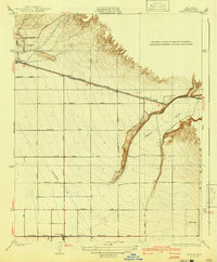
1931 Map of Edison
USGS Topo · Published 1931About this map
The settlement of Edison sits at the western edge of this valley landscape, serving as a hub where the Southern Pacific tracks meet the Tehachapi Highway. The terrain is defined by the alluvial fan of Caliente Creek, which cuts through the eastern portion of the sheet. This drainage pattern dictates the grid-like distribution of local transit routes such as White Wolf Road and Comanche Drive.
Find a feature on this map
23 named features on this map. Tap any name to fly to it.
Don’t see what you’re looking for? This feature index may not catch every label — zoom into the map to look around manually.
Map Details
Editions of this 1931 Edison Map
2 editions found
Other maps of this area

1906 · Bakersfield
USGS Topo · 1:62,500

1914 · Caliente
USGS Topo · 1:125,000

1929 · Bena
USGS Topo · 1:31,680

1929 · Fairfax School
USGS Topo · 1:31,680

1930 · Weed Patch
USGS Topo · 1:31,680

1930 · Bear Mountain
USGS Topo · 1:31,680

1930 · Arvin
USGS Topo · 1:31,680

1932 · Bena
USGS Topo · 1:31,680

1932 · Fairfax School
USGS Topo · 1:31,680

1933 · Arvin
USGS Topo · 1:31,680