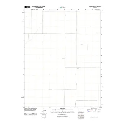
2010 Map of Edison School
USGS Topo · Published 2010About this map
The Leader Church Cemetery serves as a central historical landmark in this rural section of El Paso County. The landscape is defined by a rigorous grid of section-line roads, such as Boone Rd and Edison Rd, which facilitate transport across the high plains. Large ranching and agricultural tracts are evident through naming conventions like Johnson Ranch Vw, suggesting the long-standing influence of specific families on the local land use. This 2010 survey illustrates the persistence of a sparsely populated homesteading pattern, where connectivity relies on long thoroughfares like S Yoder Rd and North County Line Rd. The presence of the cemetery alongside Rasner Ln provides a focal point for genealogical research in an area otherwise characterized by wide-open ranch land.
Find a feature on this map
16 named features on this map. Tap any name to fly to it.
Don’t see what you’re looking for? This feature index may not catch every label — zoom into the map to look around manually.
Map Details
Editions of this 2010 Edison School Map
This is the sole edition of this map. No revisions or reprints were ever made.
Other maps of this area

1891 · Nepesta
USGS Topo · 1:125,000

1893 · Nepesta
USGS Topo · 1:125,000

1893 · Big Springs
USGS Topo · 1:125,000

1904 · Nepesta
USGS Topo · 1:125,000

1954 · Pueblo
USGS Topo · 1:250,000

1957 · Pueblo
USGS Topo · 1:250,000

1958 · Pueblo
USGS Topo · 1:250,000

1959 · Highlands Church
USGS Topo · 1:24,000
1959 · Grandview School
USGS Topo · 1:24,000

1959 · North Avondale NE
USGS Topo · 1:24,000