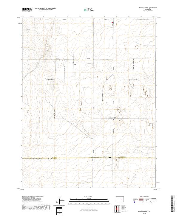
2022 Map of Edison School
USGS Topo · Published 2022About this map
The border of El Paso and Pueblo counties defines the southern portion of this landscape, where the high plains terrain is marked by a deliberate grid of rural roads and remote community landmarks. Near the intersection of Rasner Rd and Edison Rd, the Leader Church and Leader Cem stand as central points for local history and genealogy research. The area is characterized by a sparse network of section-line roads such as S Yoder Rd, Myers Rd, and Boone Rd, which facilitate movement across the large rectangular land divisions. This map illustrates the intersection of traditional land use and modern surveying, where family-named routes like Sopko Ln and S Neely Rd connect the isolated homesteads and ranching tracts common to this part of eastern Colorado.
Find a feature on this map
21 named features on this map. Tap any name to fly to it.
Don’t see what you’re looking for? This feature index may not catch every label — zoom into the map to look around manually.
Map Details
Editions of this 2022 Edison School Map
This is the sole edition of this map. No revisions or reprints were ever made.
Other maps of this area

1891 · Nepesta
USGS Topo · 1:125,000

1893 · Nepesta
USGS Topo · 1:125,000

1893 · Big Springs
USGS Topo · 1:125,000

1904 · Nepesta
USGS Topo · 1:125,000

1954 · Pueblo
USGS Topo · 1:250,000

1957 · Pueblo
USGS Topo · 1:250,000

1958 · Pueblo
USGS Topo · 1:250,000

1959 · Highlands Church
USGS Topo · 1:24,000
1959 · Grandview School
USGS Topo · 1:24,000

1959 · North Avondale NE
USGS Topo · 1:24,000