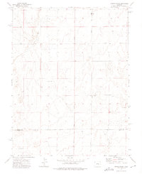
1973 Map of Edison School
USGS Topo · Published 1975About this map
Edison Road and Boone Road serve as the primary north-south conduits through this high plains landscape on the border of El Paso and Pueblo counties. The terrain is defined by its agricultural and ranching utility during the early 1970s, evidenced by scattered wells and the presence of Dry Camp. Civil life is anchored by the Edison School in the north and Leader Church further south, providing essential landmarks for a sparsely populated region. Traces of local industry and transit are found in the Gravel Pit near the northern boundary and a Jeep Trail cutting across the western contours. Named landmarks like Townsend and Buckboard appear alongside a small Cem, offering specific points of interest for genealogists and local historians tracking the families who worked this portion of the Colorado plains.
Find a feature on this map
14 named features on this map. Tap any name to fly to it.
Don’t see what you’re looking for? This feature index may not catch every label — zoom into the map to look around manually.
Map Details
Editions of this 1973 Edison School Map
This is the sole edition of this map. No revisions or reprints were ever made.
Other maps of this area

1891 · Nepesta
USGS Topo · 1:125,000

1893 · Nepesta
USGS Topo · 1:125,000

1893 · Big Springs
USGS Topo · 1:125,000

1904 · Nepesta
USGS Topo · 1:125,000

1954 · Pueblo
USGS Topo · 1:250,000

1957 · Pueblo
USGS Topo · 1:250,000

1958 · Pueblo
USGS Topo · 1:250,000

1959 · Highlands Church
USGS Topo · 1:24,000
1959 · Grandview School
USGS Topo · 1:24,000

1959 · North Avondale NE
USGS Topo · 1:24,000