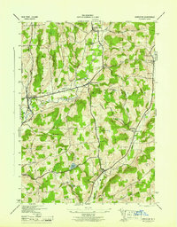
1945 Map of Edmeston
USGS Topo · Published 1945About this map
Edmeston and Burlington anchor this mid-1940s landscape, which is defined by the winding paths of Wharton Creek and Butternut Creek. The map shows a rural network of small hamlets and family-named corners such as Robinson Corners, Barrett Corners, and Taylor Corners, reflecting the agrarian community structure of mid-century Otsego County. These settlements are linked by State Routes 80 and 51, cutting through a terrain of high ridges like Rice Hill and Wooley Hill.
Find a feature on this map
43 named features on this map. Tap any name to fly to it.
Don’t see what you’re looking for? This feature index may not catch every label — zoom into the map to look around manually.
Map Details
Editions of this 1945 Edmeston Map
This is the sole edition of this map. No revisions or reprints were ever made.
Other maps of this area

1907 · Winfield
USGS Topo · 1:62,500

1907 · Sangerfield
USGS Topo · 1:62,500

1910 · Hartwick
USGS Topo · 1:62,500

1910 · New Berlin
USGS Topo · 1:62,500

1912 · New Berlin
USGS Topo · 1:62,500

1912 · Hartwick
USGS Topo · 1:62,500

1943 · Schuyler Lake
USGS Topo · 1:24,000

1943 · Mt Vision
USGS Topo · 1:24,000

1943 · New Berlin North
USGS Topo · 1:24,000

1943 · New Berlin South
USGS Topo · 1:24,000