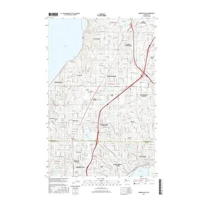
2017 Map of Edmonds East
USGS Topo · Published 2017About this map
Edmonds and Lynnwood anchor this densely developed corridor in the north Puget Sound region during the late 2010s. The landscape is defined by its transition from the shoreline at Browns Bay to the inland suburban communities of Mountlake Terrace and Shoreline. The map captures a complex network of residential neighborhoods and vital transit routes like Edmonds Way and Bothell Way NE, interspersed with significant green spaces and cemeteries. Genealogists and local historians can locate several major interment sites, including Holyrood Cem and Edmonds Memorial Cem. The area’s hydrology is well-documented, featuring smaller bodies like Stickney Lake and Hall Lake alongside the northern reach of Lake Washington. Institutional landmarks such as the Edmonds Community College campus and recreational corridors like the Burke-Gilman Trl reflect the modern infrastructure of these established Snohomish and King County suburbs.
Find a feature on this map
70 named features on this map. Tap any name to fly to it.
Don’t see what you’re looking for? This feature index may not catch every label — zoom into the map to look around manually.
Map Details
Editions of this 2017 Edmonds East Map
This is the sole edition of this map. No revisions or reprints were ever made.
Other maps of this area

1894 · Seattle
USGS Topo · 1:62,500

1895 · Snohomish
USGS Topo · 1:125,000

1897 · Seattle
USGS Topo · 1:125,000

1908 · Seattle
USGS Topo · 1:62,500

1909 · Seattle Special
USGS Topo · 1:62,500

1942 · Edmonds
USGS Topo · 1:62,500

1944 · Everett
USGS Topo · 1:62,500

1949 · Shilshole Bay
USGS Topo · 1:24,000

1949 · Seattle North
USGS Topo · 1:24,000

1950 · Kirkland
USGS Topo · 1:24,000