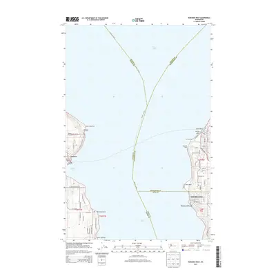
2014 Map of Edmonds West
USGS Topo · Published 2014About this map
Kingston Ferry Landing and its counterpart Edmonds Ferry Landing across the deep waters of Puget Sound define the maritime character of this region in 2014. The survey documents the essential ferry connections and nautical traffic lanes of the Seattle - Victoria route, which bisects the sound. On the eastern shore, the residential patterns of Shoreline and Richmond Beach press against the coast near Point Wells, while the western side features the more dispersed settlement of the Great Peninsula. Nautical navigation is anchored by the Apple Cove Point Light at the entrance to Appletree Cove. This period shows the refined infrastructure of the Port of Edmonds and the Port of Kingston Marina, reflecting a coastal economy centered on transit and recreational access to the waterway.
Find a feature on this map
66 named features on this map. Tap any name to fly to it.
Don’t see what you’re looking for? This feature index may not catch every label — zoom into the map to look around manually.
Map Details
Editions of this 2014 Edmonds West Map
This is the sole edition of this map. No revisions or reprints were ever made.
Other maps of this area

1894 · Seattle
USGS Topo · 1:62,500

1895 · Snohomish
USGS Topo · 1:125,000

1897 · Seattle
USGS Topo · 1:125,000

1908 · Seattle
USGS Topo · 1:62,500

1909 · Seattle Special
USGS Topo · 1:62,500

1937 · Port Orchard
USGS Topo · 1:62,500

1937 · Port Gamble
USGS Topo · 1:62,500

1940 · Port Gamble
USGS Topo · 1:62,500

1942 · Edmonds
USGS Topo · 1:62,500

1949 · Shilshole Bay
USGS Topo · 1:24,000