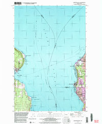
1997 Map of Edmonds West
USGS Topo · Published 2003About this map
Puget Sound serves as the central corridor of this late 20th-century survey, dividing the residential and industrial shorelines of Snohomish and King counties from the Kitsap Peninsula. On the eastern shore, the transition from the city of Edmonds through Woodway to Richmond Beach shows a developed landscape defined by coastal bluffs and terminal facilities like the oil tanks at Point Wells. To the west, the community of Kingston anchors the mouth of Appletree Cove, while further south, the map reveals the northern extent of the Fort Madison Indian Reservation and an adjacent Naval Reservation at Point Jefferson. Maritime activity is heavily documented, from the ferry routes connecting the shores to the location of a sunken wreck off Apple Cove Point, illustrating the deep-water navigation required for the Seattle - Vancouver passage.
Find a feature on this map
27 named features on this map. Tap any name to fly to it.
Don’t see what you’re looking for? This feature index may not catch every label — zoom into the map to look around manually.
Map Details
Editions of this 1997 Edmonds West Map
This is the sole edition of this map. No revisions or reprints were ever made.
Other maps of this area

1894 · Seattle
USGS Topo · 1:62,500

1895 · Snohomish
USGS Topo · 1:125,000

1897 · Seattle
USGS Topo · 1:125,000

1908 · Seattle
USGS Topo · 1:62,500

1909 · Seattle Special
USGS Topo · 1:62,500

1937 · Port Orchard
USGS Topo · 1:62,500

1937 · Port Gamble
USGS Topo · 1:62,500

1940 · Port Gamble
USGS Topo · 1:62,500

1942 · Edmonds
USGS Topo · 1:62,500

1949 · Shilshole Bay
USGS Topo · 1:24,000