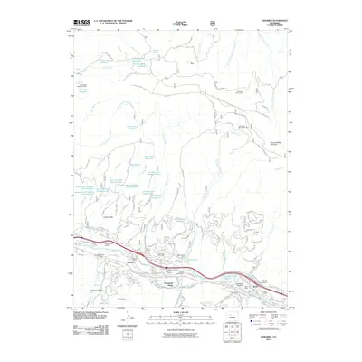
2011 Map of Edwards
USGS Topo · Published 2011About this map
Eagle River water management dominates this high-country landscape, where a sophisticated network of reservoirs and ditches supports both local agriculture and the modern resort economy. The southern corridor is densely developed, featuring the growing communities of Edwards and Avon, alongside the Sonnenalp Resort of Vail. This 2011 survey captures the transition from traditional land uses, represented by the Edwards Siding and Edwards Cemetery, to contemporary mountain living in Arrowhead Village. North of the valley, the terrain rises toward Rock Creek Park and Red and White Mountain, where the legacy of extraction remains visible at the Arrowhead Claims Mine. High-altitude water storage is particularly intricate here, with numerous small impoundments such as the Lost Reservoir Number One and Tames Number One Reservoir dotting the northern slopes to manage runoff from the alpine snowmelt.
Find a feature on this map
113 named features on this map. Tap any name to fly to it.
Don’t see what you’re looking for? This feature index may not catch every label — zoom into the map to look around manually.
Map Details
Editions of this 2011 Edwards Map
This is the sole edition of this map. No revisions or reprints were ever made.
Other maps of this area

1933 · Mt. Powell
USGS Topo · 1:48,000

1934 · Minturn
USGS Topo · 1:62,500

1940 · Mount Powell
USGS Topo · 1:62,500

1950 · Minturn
USGS Topo · 1:62,500

1957 · Leadville
USGS Topo · 1:250,000

1959 · Leadville
USGS Topo · 1:250,000

1960 · Leadville
USGS Topo · 1:250,000

1962 · Leadville
USGS Topo · 1:250,000

1962 · Grouse Mountain
USGS Topo · 1:24,000

1962 · Fulford
USGS Topo · 1:24,000