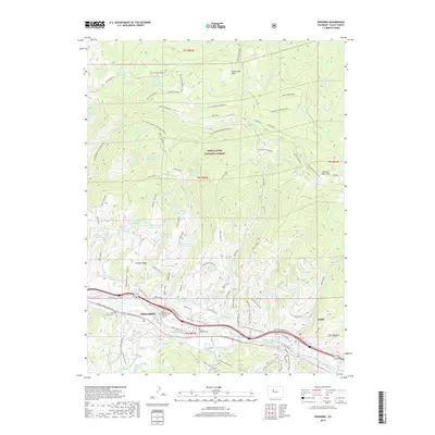
2019 Map of Edwards
USGS Topo · Published 2019About this map
Edwards and Avon anchor this 2019 Eagle Valley study, situated along the Eagle River corridor. The map shows a landscape defined by water management and outdoor recreation, with numerous high-altitude catchments like Jouflas Spring Reservoir and the Lost Reservoir Number One complex peppered throughout the White River National Forest. For those tracing local families, the Edwards Cem and the Brett Family Cem are clearly marked near the river.
Find a feature on this map
93 named features on this map. Tap any name to fly to it.
Don’t see what you’re looking for? This feature index may not catch every label — zoom into the map to look around manually.
Map Details
Editions of this 2019 Edwards Map
This is the sole edition of this map. No revisions or reprints were ever made.
Other maps of this area

1933 · Mt. Powell
USGS Topo · 1:48,000

1934 · Minturn
USGS Topo · 1:62,500

1940 · Mount Powell
USGS Topo · 1:62,500

1950 · Minturn
USGS Topo · 1:62,500

1957 · Leadville
USGS Topo · 1:250,000

1959 · Leadville
USGS Topo · 1:250,000

1960 · Leadville
USGS Topo · 1:250,000

1962 · Leadville
USGS Topo · 1:250,000

1962 · Grouse Mountain
USGS Topo · 1:24,000

1962 · Fulford
USGS Topo · 1:24,000