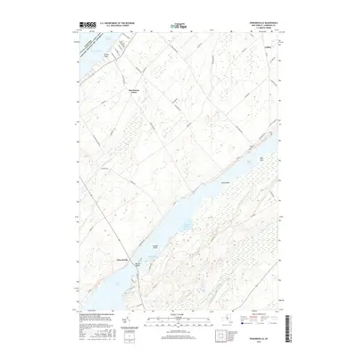
2016 Map of Edwardsville
USGS Topo · Published 2016About this map
The Saint Lawrence River marks the international border between New York and Ontario at the northern edge of this landscape, where Brooks Point and the Lake of the Isles define the shoreline near Morristown Center. Moving inland, the geography shifts to the intricate marshlands and open waters of Black Lake, which dominates the southern half of the quadrangle. This area is characterized by numerous islands such as Snake Island, Jennies Island, and Booths Island, illustrating the complex drainage patterns of Fish Creek as it enters Mitchell Bay. Settlement is concentrated at the crossroads of Edwardsville and the small northern hamlet of Galilee. Local history is anchored by features like the Davies Cem near Oak Point, while an extensive network of rural routes, including Lost Village Rd and Stone Church Rd, provides a clear view of land use and family farm placement in St. Lawrence County during the early 21st century.
Find a feature on this map
54 named features on this map. Tap any name to fly to it.
Don’t see what you’re looking for? This feature index may not catch every label — zoom into the map to look around manually.
Map Details
Editions of this 2016 Edwardsville Map
This is the sole edition of this map. No revisions or reprints were ever made.
Other maps of this area

1904 · Ogdensburg
USGS Topo · 1:62,500

1905 · Ogdensburg
USGS Topo · 1:62,500

1906 · Brier Hill
USGS Topo · 1:62,500

1912 · Hammond
USGS Topo · 1:62,500

1915 · Gouverneur
USGS Topo · 1:62,500

1937 · Gouverneur
USGS Topo · 1:62,500

1942 · Morristown
USGS Topo · 1:24,000

1943 · Ogdensburg East
USGS Topo · 1:31,680

1943 · Morristown
USGS Topo · 1:31,680

1943 · Edwardsville
USGS Topo · 1:31,680