
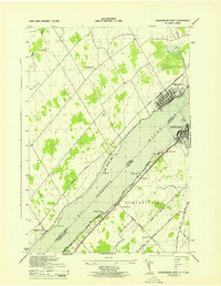
1943 Map of Edwardsville
USGS Topo · Published 1943About this map
The St Lawrence River and the sprawling waters of Black Lake dominate this 1943 survey of St. Lawrence County, showing a landscape defined by its waterways and rural township divisions. The community of Edwardsville sits at the narrow crossing between the lake’s main body and its southern reach, near Booths Island and Jennies Island. Further north, the New York Central railroad cuts a diagonal line across the terrain, passing through Morristown Center on its way toward the riverfront.
Find a feature on this map
44 named features on this map. Tap any name to fly to it.
Don’t see what you’re looking for? This feature index may not catch every label — zoom into the map to look around manually.
Map Details
Editions of this 1943 Edwardsville Map
This is the sole edition of this map. No revisions or reprints were ever made.
Other maps of this area

1904 · Ogdensburg
USGS Topo · 1:62,500

1905 · Ogdensburg
USGS Topo · 1:62,500

1906 · Brier Hill
USGS Topo · 1:62,500

1912 · Hammond
USGS Topo · 1:62,500

1915 · Gouverneur
USGS Topo · 1:62,500

1937 · Gouverneur
USGS Topo · 1:62,500

1942 · Morristown
USGS Topo · 1:24,000

1943 · Ogdensburg East
USGS Topo · 1:31,680

1943 · Morristown
USGS Topo · 1:31,680
1943 · Ogdensburg West
USGS Topo · 1:31,680