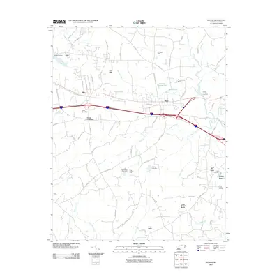
2011 Map of Efland
USGS Topo · Published 2011About this map
The Eno River winds through the eastern portion of this Piedmont landscape, which is defined by a series of residential developments and rural crossroads in the early 21st century. The settlement of Efland serves as a central point of reference, situated near the headwaters of McGowan Creek and Sevenmile Creek. The map documents a blend of traditional agricultural heritage and modern suburban growth, evidenced by the proximity of Cheeks Crossroads to newer neighborhoods like Stagecoach Forest and Perry Hills.
Find a feature on this map
88 named features on this map. Tap any name to fly to it.
Don’t see what you’re looking for? This feature index may not catch every label — zoom into the map to look around manually.
Map Details
Editions of this 2011 Efland Map
This is the sole edition of this map. No revisions or reprints were ever made.
Other maps of this area

1946 · Chapel Hill
USGS Topo · 1:24,000

1947 · Chapel Hill
USGS Topo · 1:31,680

1953 · Raleigh
USGS Topo · 1:250,000

1953 · Greensboro
USGS Topo · 1:250,000

1954 · Greensboro
USGS Topo · 1:250,000

1954 · Raleigh
USGS Topo · 1:250,000

1962 · Greensboro
USGS Topo · 1:250,000

1966 · Greensboro
USGS Topo · 1:250,000

1967 · Cedar Grove
USGS Topo · 1:24,000

1968 · White Cross
USGS Topo · 1:24,000