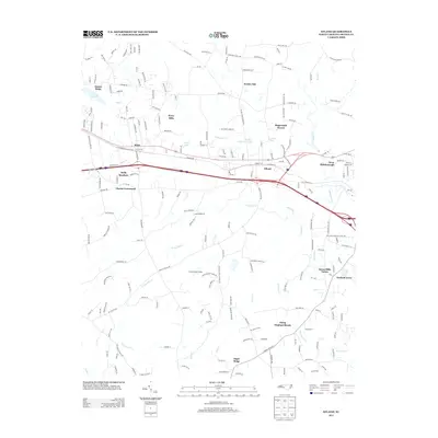
2013 Map of Efland
USGS Topo · Published 2013About this map
The unincorporated community of Efland serves as a central hub in this corridor between Mebane and Hillsborough, where interstate development meets older residential patterns. The landscape is characterized by a dense network of residential subdivisions and family-named tracts, such as Sunset Ridge, Perry Hills, and Stagecoach Forest, which have integrated into the Piedmont terrain. Many of these developments are centered around small water bodies, including Crystal Lake and Orange-Alamance Lake, reflecting the suburban expansion of the early 21st century.
Find a feature on this map
203 named features on this map. Tap any name to fly to it.
Don’t see what you’re looking for? This feature index may not catch every label — zoom into the map to look around manually.
Map Details
Editions of this 2013 Efland Map
This is the sole edition of this map. No revisions or reprints were ever made.
Other maps of this area

1946 · Chapel Hill
USGS Topo · 1:24,000

1947 · Chapel Hill
USGS Topo · 1:31,680

1953 · Raleigh
USGS Topo · 1:250,000

1953 · Greensboro
USGS Topo · 1:250,000

1954 · Greensboro
USGS Topo · 1:250,000

1954 · Raleigh
USGS Topo · 1:250,000

1962 · Greensboro
USGS Topo · 1:250,000

1966 · Greensboro
USGS Topo · 1:250,000

1967 · Cedar Grove
USGS Topo · 1:24,000

1968 · White Cross
USGS Topo · 1:24,000