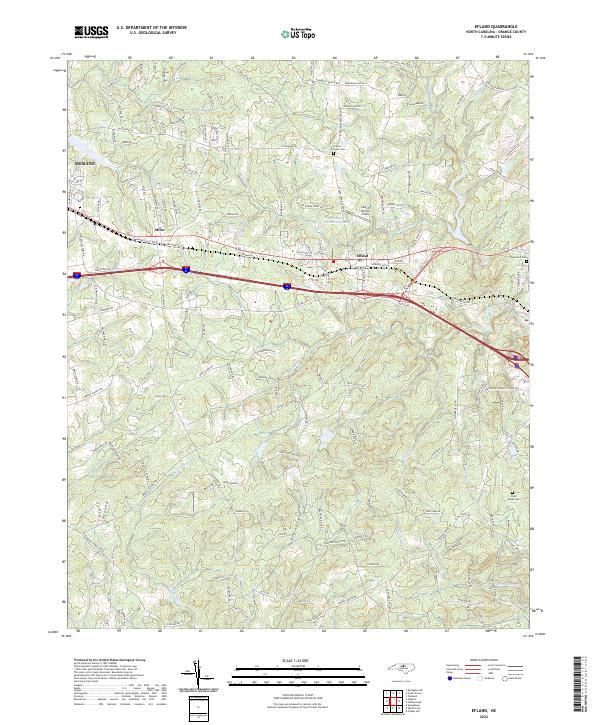
2022 Map of Efland
USGS Topo · Published 2022About this map
Efland serves as the central hub of this modern survey, situated along the busy transportation corridor that bisects Orange County. The landscape is defined by the headwaters of several significant regional waterways, including the Eno River to the northeast and New Hope Cr to the south. The proximity of the Mebane municipal border on the western edge highlights the ongoing suburban transition in this part of North Carolina, where residential developments like those surrounding Crystal Lake and Orange-Alamance Lake are interspersed with older landmarks. Genealogists will find several burial sites preserved amidst the shifting land use, including County Home Cem and Cross Roads Cem. The terrain is complex, with numerous small tributaries like Sevenmile Cr and Turkey Hill Cr carving through the Piedmont hills, illustrating the natural drainage patterns that have influenced local settlement since the early days of the county.
Find a feature on this map
170 named features on this map. Tap any name to fly to it.
Don’t see what you’re looking for? This feature index may not catch every label — zoom into the map to look around manually.
Map Details
Editions of this 2022 Efland Map
This is the sole edition of this map. No revisions or reprints were ever made.
Other maps of this area

1946 · Chapel Hill
USGS Topo · 1:24,000

1947 · Chapel Hill
USGS Topo · 1:31,680

1953 · Raleigh
USGS Topo · 1:250,000

1953 · Greensboro
USGS Topo · 1:250,000

1954 · Greensboro
USGS Topo · 1:250,000

1954 · Raleigh
USGS Topo · 1:250,000

1962 · Greensboro
USGS Topo · 1:250,000

1966 · Greensboro
USGS Topo · 1:250,000

1967 · Cedar Grove
USGS Topo · 1:24,000

1968 · White Cross
USGS Topo · 1:24,000