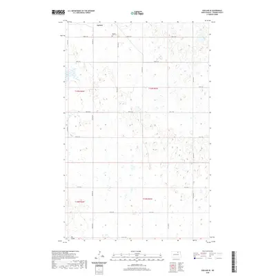
1962 Map of Egeland SE
USGS Topo · Published 1963About this map
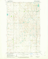
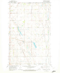
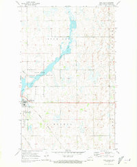
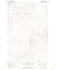
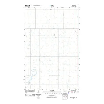
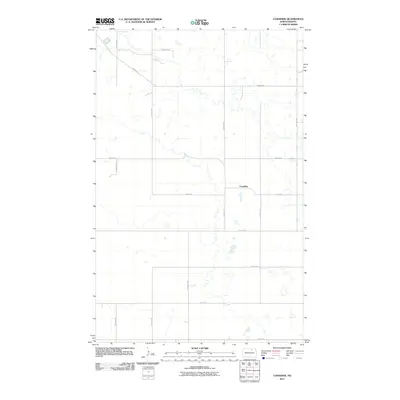
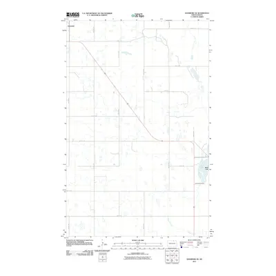
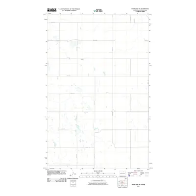
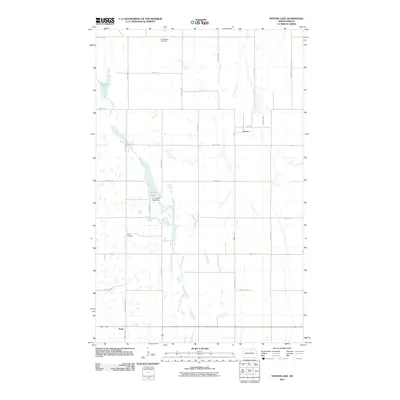
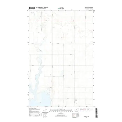
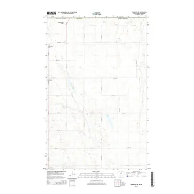
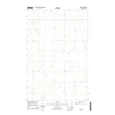
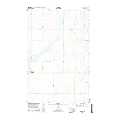
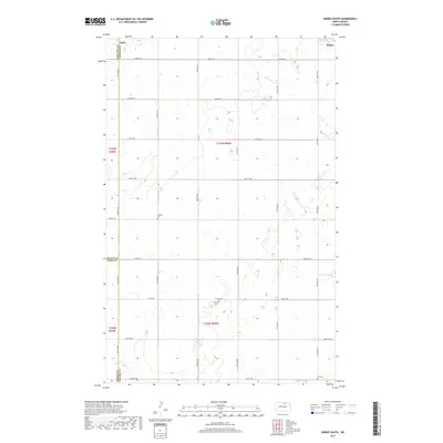
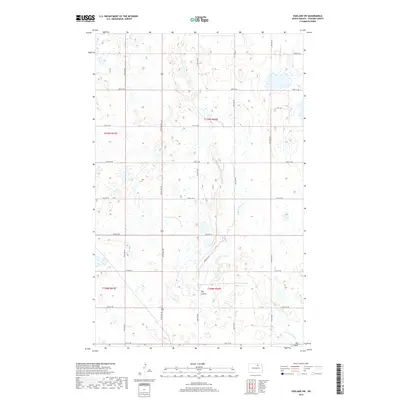
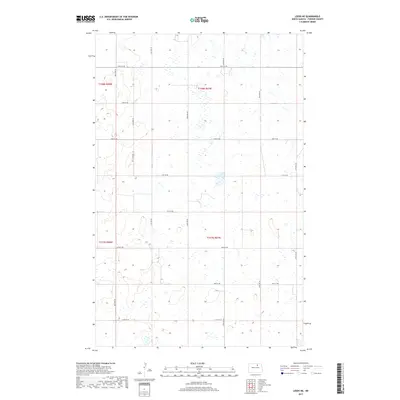
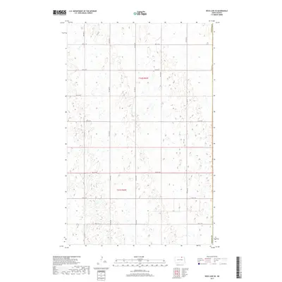
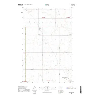
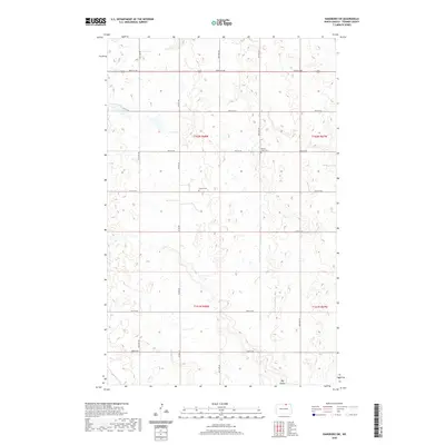
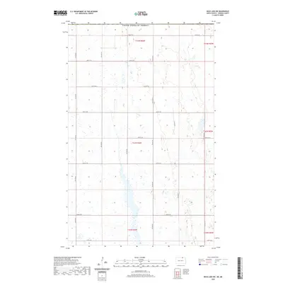
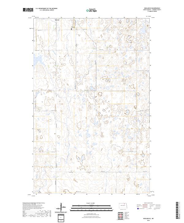
Egeland sits at the northern edge of this prairie landscape, serving as a focal point for the surrounding agricultural townships of Victor, Cando, and Bethel. The Great Northern railroad cuts a diagonal path across the northeastern section, a vital transit link for the grain-producing region in the early 1960s. For those tracing family history, the Egeland Cem is clearly marked just south of the town site. The terrain is characterized by the complex wetland depressions typical of the Missouri River Basin development area, with numerous small potholes and ponds scattered across the plains of Paulson. A solitary Radio Tower stands as a modern landmark against the traditional section-line road grid, which is further detailed by fine dashed lines representing fence and field boundaries from the era.
Find a feature on this map
9 named features on this map. Tap any name to fly to it.
Don’t see what you’re looking for? This feature index may not catch every label — zoom into the map to look around manually.
Map Details
Editions of this 1962 Egeland SE Map
This is the sole edition of this map. No revisions or reprints were ever made.
Historical Maps of Egeland Through Time
103 maps found
1957 Cando NE
Towner County, ND
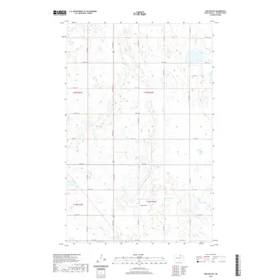
1962 Egeland SE
Towner County, ND
1962 Egeland SW
Towner County, ND
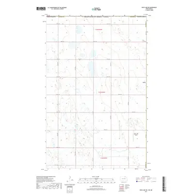
1962 Snyder Lake
Towner County, ND
1969 Hansboro NE
Towner County, ND
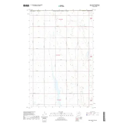
1969 Rock Lake NE
Towner County, ND

1969 Rock Lake NW
Towner County, ND
1970 Hansboro SE
Towner County, ND
1970 Hansboro SW
Towner County, ND

1970 Rock Lake SE
Towner County, ND
1970 Rock Lake
Towner County, ND
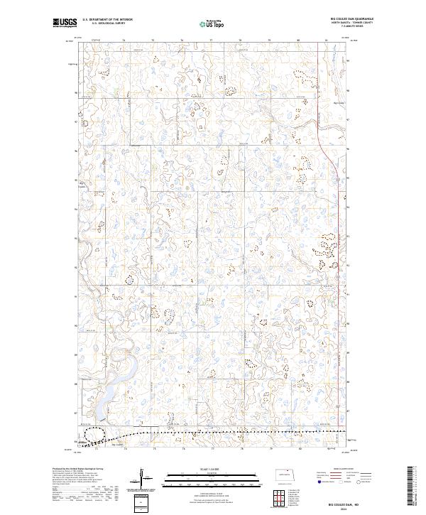
1971 Big Coulee Dam
Towner County, ND
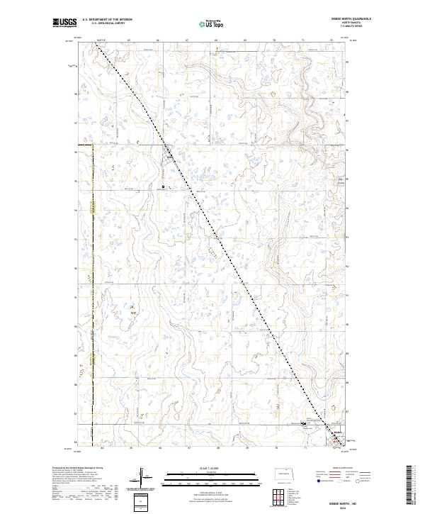
1971 Bisbee North
Towner County, ND
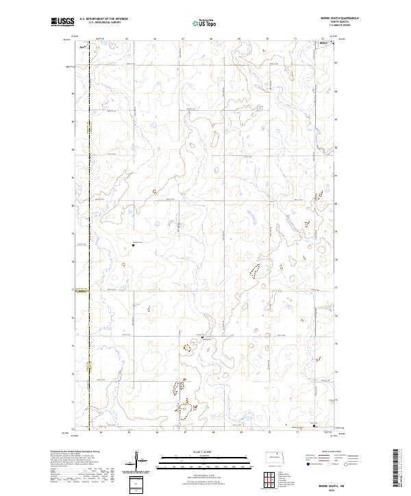
1971 Bisbee South
Towner County, ND
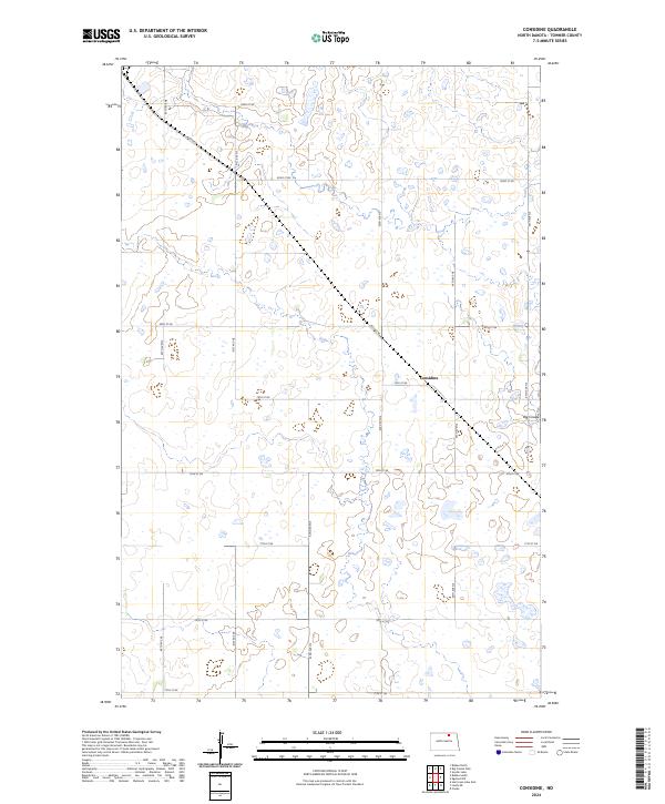
1971 Considine
Towner County, ND
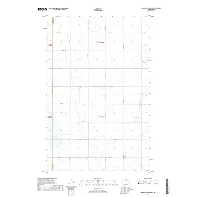
1971 Hurricane Lake East
Towner County, ND
1971 Leeds NE
Towner County, ND
1985 Rock Lake
Towner County, ND
2011 Big Coulee Dam
Towner County, ND
2011 Bisbee North
Towner County, ND
2011 Bisbee South
Towner County, ND
2011 Cando NE
Towner County, ND
2011 Considine
Towner County, ND
2011 Egeland SE
Towner County, ND
2011 Egeland SW
Towner County, ND
2011 Hansboro NE
Towner County, ND
2011 Hansboro SE
Towner County, ND
2011 Hansboro SW
Towner County, ND
2011 Hurricane Lake East
Towner County, ND
2011 Leeds NE
Towner County, ND
2011 Rock Lake NE
Towner County, ND
2011 Rock Lake NW
Towner County, ND
2011 Rock Lake SE
Towner County, ND
2011 Rock Lake
Towner County, ND
2011 Snyder Lake
Towner County, ND
2014 Big Coulee Dam
Towner County, ND
2014 Bisbee North
Towner County, ND
2014 Bisbee South
Towner County, ND
2014 Cando NE
Towner County, ND
2014 Considine
Towner County, ND
2014 Egeland SE
Towner County, ND
2014 Egeland SW
Towner County, ND
2014 Hansboro NE
Towner County, ND
2014 Hansboro SE
Towner County, ND
2014 Hansboro SW
Towner County, ND
2014 Hurricane Lake East
Towner County, ND
2014 Leeds NE
Towner County, ND
2014 Rock Lake NE
Towner County, ND
2014 Rock Lake NW
Towner County, ND
2014 Rock Lake SE
Towner County, ND
2014 Rock Lake
Towner County, ND
2014 Snyder Lake
Towner County, ND
2017 Big Coulee Dam
Towner County, ND
2017 Bisbee North
Towner County, ND
2017 Bisbee South
Towner County, ND
2017 Cando NE
Towner County, ND
2017 Considine
Towner County, ND
2017 Egeland SE
Towner County, ND
2017 Egeland SW
Towner County, ND
2017 Hansboro NE
Towner County, ND
2017 Hansboro SE
Towner County, ND
2017 Hansboro SW
Towner County, ND
2017 Hurricane Lake East
Towner County, ND
2017 Leeds NE
Towner County, ND
2017 Rock Lake NE
Towner County, ND
2017 Rock Lake NW
Towner County, ND
2017 Rock Lake SE
Towner County, ND
2017 Rock Lake
Towner County, ND
2017 Snyder Lake
Towner County, ND
2020 Big Coulee Dam
Towner County, ND
2020 Bisbee North
Towner County, ND
2020 Bisbee South
Towner County, ND
2020 Cando NE
Towner County, ND
2020 Considine
Towner County, ND
2020 Egeland SE
Towner County, ND
2020 Egeland SW
Towner County, ND
2020 Hansboro NE
Towner County, ND
2020 Hansboro SE
Towner County, ND
2020 Hansboro SW
Towner County, ND
2020 Hurricane Lake East
Towner County, ND
2020 Leeds NE
Towner County, ND
2020 Rock Lake NE
Towner County, ND
2020 Rock Lake NW
Towner County, ND
2020 Rock Lake SE
Towner County, ND
2020 Rock Lake
Towner County, ND
2020 Snyder Lake
Towner County, ND
2024 Big Coulee Dam
Towner County, ND
2024 Bisbee North
Towner County, ND
2024 Bisbee South
Towner County, ND

2024 Cando NE
Towner County, ND
2024 Considine
Towner County, ND
2024 Egeland SE
Towner County, ND
2024 Egeland SW
Towner County, ND
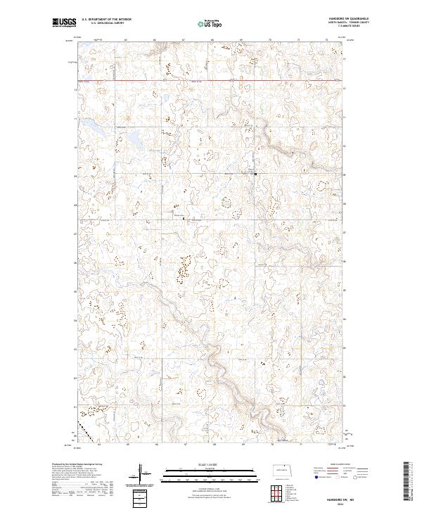
2024 Hansboro NE
Towner County, ND
2024 Hansboro SE
Towner County, ND
2024 Hansboro SW
Towner County, ND
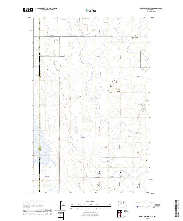
2024 Hurricane Lake East
Towner County, ND
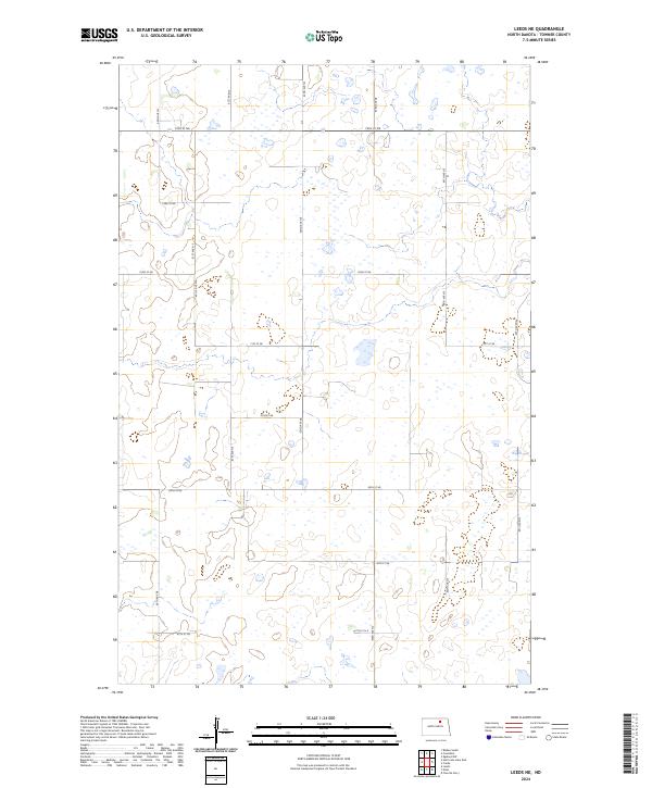
2024 Leeds NE
Towner County, ND
2024 Rock Lake NE
Towner County, ND
2024 Rock Lake NW
Towner County, ND
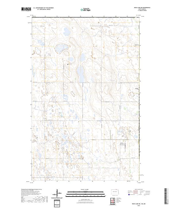
2024 Rock Lake SE
Towner County, ND
2024 Rock Lake
Towner County, ND
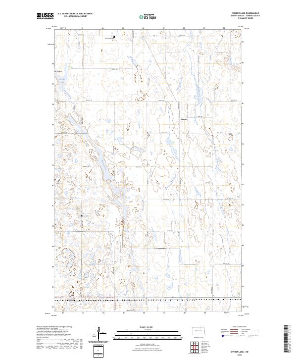
2024 Snyder Lake
Towner County, ND