
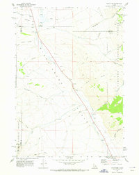
1969 Map of Eightmile Canyon
USGS Topo · Published 1973About this map
The Indian Massacre Historical Monument stands as a somber landmark on the eastern edge of the Lemhi Range, overlooking the wide expanse of the Birch Creek Valley. This 1969 survey captures a transition from the high, timbered ridges of the Targhee National Forest and Challis National Forest to the arid alluvial fans of the valley floor. The geography is defined by a series of parallel drainages, including Eightmile Canyon, Windfall Canyon, and Surrett Canyon, which carve deeply into the mountain front. Historically significant pathways like the Mormon Trail and various stretches of Jeep Trail trace the movements of early settlers and miners across this landscape. Near the higher elevations, Bald Mountain Spring provides a vital water source in an otherwise dry, high-altitude environment marked by peaks like Bald Mountain and Mahogany Butte.
Find a feature on this map
24 named features on this map. Tap any name to fly to it.
Don’t see what you’re looking for? This feature index may not catch every label — zoom into the map to look around manually.
Map Details
Editions of this 1969 Eightmile Canyon Map
This is the sole edition of this map. No revisions or reprints were ever made.
Other maps of this area

1955 · Dubois
USGS Topo · 1:250,000

1955 · Idaho Falls
USGS Topo · 1:250,000

1957 · Diamond Peak
USGS Topo · 1:62,500

1958 · Dubois
USGS Topo · 1:250,000

1958 · Idaho Falls
USGS Topo · 1:250,000

1969 · Richard Butte
USGS Topo · 1:24,000

1969 · Tyler Peak
USGS Topo · 1:24,000

1969 · Copper Mtn
USGS Topo · 1:24,000

1969 · Howe NE
USGS Topo · 1:24,000
1969 · Blue Dome
USGS Topo · 1:24,000