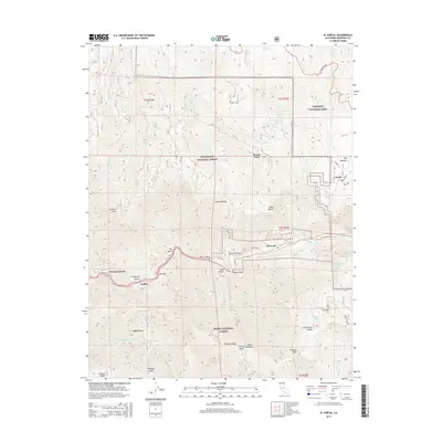
2015 Map of El Portal
USGS Topo · Published 2015About this map
El Portal serves as a central gateway on the Merced River canyon floor, where modern settlement meets the dramatic wilderness of three protected lands. This area is a point of convergence for Yosemite National Park, Stanislaus National Forest, and Sierra National Forest. The map details a landscape defined by steep elevation changes, moving from the river valley at Rancheria Flat up toward prominent landmarks like Trumbull Peak and Eagle Peak. Along the southern reaches, the South Fork Merced River flows past the location of Hite Cove, a site with deep roots in regional history.
Find a feature on this map
45 named features on this map. Tap any name to fly to it.
Don’t see what you’re looking for? This feature index may not catch every label — zoom into the map to look around manually.
Map Details
Editions of this 2015 El Portal Map
This is the sole edition of this map. No revisions or reprints were ever made.
Other maps of this area

1897 · Yosemite
USGS Topo · 1:125,000

1900 · Yosemite
USGS Topo · 1:125,000

1903 · Yosemite
USGS Topo · 1:125,000

1909 · Yosemite
USGS Topo · 1:125,000

1947 · El Portal
USGS Topo · 1:24,000

1947 · Mariposa
USGS Topo · 1:250,000

1947 · El Portal
USGS Topo · 1:62,500

1947 · Buckingham Mtn
USGS Topo · 1:24,000
1947 · Feliciana Mtn.
USGS Topo · 1:24,000
1947 · Kinsley
USGS Topo · 1:24,000