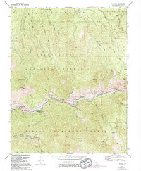
1992 Map of El Portal
USGS Topo · Published 1995About this map
Merced Grove Big Trees stands at the northwestern edge of this landscape, marking a transition into the Yosemite Wilderness and the broader Yosemite National Park. The topography is dominated by the steep canyons carved by the Merced River and its South Fork Merced River, which are designated as the Merced Wild and Scenic River. The settlement of El Portal serves as a gateway node along the river, flanked by administrative and recreational sites like Rancheria Flat and the Indian Flat Guard Sta Campground.
Find a feature on this map
52 named features on this map. Tap any name to fly to it.
Don’t see what you’re looking for? This feature index may not catch every label — zoom into the map to look around manually.
Map Details
Editions of this 1992 El Portal Map
This is the sole edition of this map. No revisions or reprints were ever made.
Other maps of this area

1897 · Yosemite
USGS Topo · 1:125,000

1900 · Yosemite
USGS Topo · 1:125,000

1903 · Yosemite
USGS Topo · 1:125,000

1909 · Yosemite
USGS Topo · 1:125,000

1947 · El Portal
USGS Topo · 1:24,000

1947 · Mariposa
USGS Topo · 1:250,000

1947 · El Portal
USGS Topo · 1:62,500

1947 · Buckingham Mtn
USGS Topo · 1:24,000
1947 · Feliciana Mtn.
USGS Topo · 1:24,000
1947 · Kinsley
USGS Topo · 1:24,000