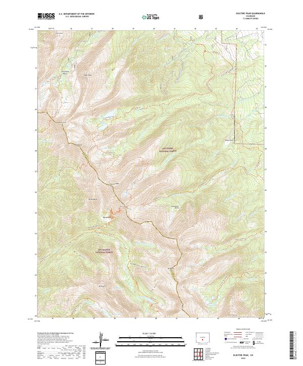
2022 Map of Electric Peak
USGS Topo · Published 2022About this map
Electric Peak towers over the high-altitude divide between the San Isabel National Forest and the Rio Grande National Forest. The landscape is defined by the sharp topographical boundary between the Saguache Co Custer Co line, where glacial cirques and alpine basins hold high-mountain waters such as Silver Lake, Cotton Lake, and the Lake of the Clouds. A sophisticated network of primitive routes, including the Rainbow Trl and Horsethief Basin Trl, connects these remote summits to the drainages of Stover Gulch and Mill Gulch. This modern survey details the hydrological patterns of the Sangre de Cristo Range, showing where seasonal snowmelt feeds the headwaters of Texas Cr and N Brush Cr before they descend into the valleys below.
Find a feature on this map
68 named features on this map. Tap any name to fly to it.
Don’t see what you’re looking for? This feature index may not catch every label — zoom into the map to look around manually.
Map Details
Editions of this 2022 Electric Peak Map
This is the sole edition of this map. No revisions or reprints were ever made.
Other maps of this area

1950 · Valley View Hot Springs
USGS Topo · 1:24,000

1954 · Pueblo
USGS Topo · 1:250,000

1957 · Pueblo
USGS Topo · 1:250,000

1958 · Pueblo
USGS Topo · 1:250,000

1958 · Beckwith Mountain
USGS Topo · 1:24,000

1959 · Electric Peak
USGS Topo · 1:62,500

1959 · Howard
USGS Topo · 1:62,500
1959 · Horn Peak
USGS Topo · 1:24,000

1959 · Cotopaxi
USGS Topo · 1:62,500

1962 · Pueblo
USGS Topo · 1:250,000