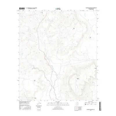
2016 Map of Elephant Mountain
USGS Topo · Published 2016About this map
Elephant Mountain rises prominently above the high desert floor of Brewster County, anchoring a landscape defined by dramatic volcanic landforms and seasonal drainages. This high-altitude terrain is marked by expansive flat-topped features like Nevill Mesa and Crossen Mesa, which overlook the surrounding basins. Running centrally through the quadrangle, Calamity Creek and its tributaries carve paths through the arid environment, paralleled by the path of Highway 118. To the south, the terrain drops into Torvea Canyon, while Maravillas Cr drains the eastern slopes of the highlands. This survey documents the complex topography and limited road infrastructure of the Big Bend region, showcasing the geological scale of the Trans-Pecos where cattle ranching and nature conservation intersect.
Find a feature on this map
13 named features on this map. Tap any name to fly to it.
Don’t see what you’re looking for? This feature index may not catch every label — zoom into the map to look around manually.
Map Details
Editions of this 2016 Elephant Mountain Map
This is the sole edition of this map. No revisions or reprints were ever made.
Other maps of this area

1895 · Alpine
USGS Topo · 1:125,000

1917 · Santiago Peak
USGS Topo · 1:62,500

1917 · Buck Hill
USGS Topo · 1:62,500

1918 · Bone Spring
USGS Topo · 1:125,000

1918 · Buck Hill
USGS Topo · 1:62,500

1918 · Santiago Peak
USGS Topo · 1:62,500

1920 · Monument Spring
USGS Topo · 1:62,500

1921 · Monument Spring
USGS Topo · 1:62,500

1925 · Buck Hill
USGS Topo · 1:62,500
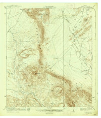
1938 · Santiago Peak
USGS Topo · 1:62,500