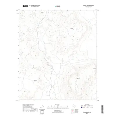
2019 Map of Elephant Mountain
USGS Topo · Published 2019About this map
Elephant Mtn dominates the eastern landscape of this Brewster County region, where high desert plateaus and deeply cut drainages define the Chihuahuan Desert terrain. The hydrology of the area is centered on Calamity Creek, which winds through the center of the sheet, joined by smaller tributaries like Sheep Creek. These watercourses have carved significant landforms over time, including the expansive Nevill Mesa and Crossen Mesa to the west. This 2019 survey documents the modern layout of the land, showing how transportation routes follow the natural contours of the basin floor. To the east, the terrain descends into Chalk Valley before meeting the drainage of Maravillas Cr, while the southern edge of the quadrangle is marked by the sharp relief of Torvea Canyon.
Find a feature on this map
11 named features on this map. Tap any name to fly to it.
Don’t see what you’re looking for? This feature index may not catch every label — zoom into the map to look around manually.
Map Details
Editions of this 2019 Elephant Mountain Map
This is the sole edition of this map. No revisions or reprints were ever made.
Other maps of this area

1895 · Alpine
USGS Topo · 1:125,000

1917 · Santiago Peak
USGS Topo · 1:62,500

1917 · Buck Hill
USGS Topo · 1:62,500

1918 · Bone Spring
USGS Topo · 1:125,000

1918 · Buck Hill
USGS Topo · 1:62,500

1918 · Santiago Peak
USGS Topo · 1:62,500

1920 · Monument Spring
USGS Topo · 1:62,500

1921 · Monument Spring
USGS Topo · 1:62,500

1925 · Buck Hill
USGS Topo · 1:62,500
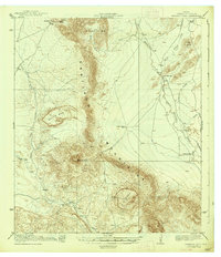
1938 · Santiago Peak
USGS Topo · 1:62,500