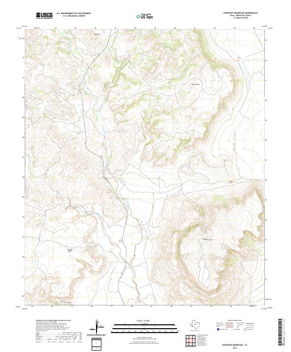
2022 Map of Elephant Mountain
USGS Topo · Published 2022About this map
Elephant Mtn dominates the southeastern quadrant of this Brewster County landscape, serving as a massive topographical anchor in an area defined by broad mesas and winding seasonal drainage systems. The rugged central corridor is shaped by the meandering course of Calamity Creek, which flows southward through the heart of the territory. This 2022 survey illustrates a classic Big Bend landscape where high-elevation landmarks like Nevill Mesa and Crossen Mesa provide significant vertical relief against the surrounding flats. The map highlights the sparse infrastructure characteristic of this arid region, where land use is dictated by the natural corridors of Chalk Valley and the steep descents into Torvea Canyon. These features indicate a terrain where water, even in ephemeral forms like Maravillas Cr, remains the primary architect of the environment and the historically limited human settlement patterns.
Find a feature on this map
11 named features on this map. Tap any name to fly to it.
Don’t see what you’re looking for? This feature index may not catch every label — zoom into the map to look around manually.
Map Details
Editions of this 2022 Elephant Mountain Map
This is the sole edition of this map. No revisions or reprints were ever made.
Other maps of this area

1895 · Alpine
USGS Topo · 1:125,000

1917 · Santiago Peak
USGS Topo · 1:62,500

1917 · Buck Hill
USGS Topo · 1:62,500

1918 · Bone Spring
USGS Topo · 1:125,000

1918 · Buck Hill
USGS Topo · 1:62,500

1918 · Santiago Peak
USGS Topo · 1:62,500

1920 · Monument Spring
USGS Topo · 1:62,500

1921 · Monument Spring
USGS Topo · 1:62,500

1925 · Buck Hill
USGS Topo · 1:62,500
1938 · Santiago Peak
USGS Topo · 1:62,500