2024 Map of Elfers
USGS Topo · Published 2024About this map
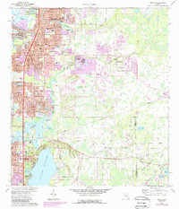
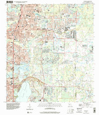
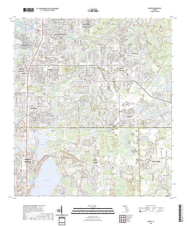
Elfers and the surrounding coastal communities of western Florida are defined by a complex network of freshwater lakes and Gulf-connected waterways. The transition from the Pithlachascotee River in the north to the expansive Lake Tarpon in the south illustrates the hydrological character of the region. Local heritage is preserved in sites like East Elfers Cem and Cycadia Cem, while the modern suburban landscape connects New Port Richey and Holiday along the corridor of S R 54. Large protected areas, including the Starkey Wilderness Preserve Tri and Brooker Creek Preserve Tri, border the increasingly developed residential sectors. This era of settlement is further characterized by local landmarks like the Trinity College of Florida and the sprawling Meadowlawn Memorial Gardens.
Find a feature on this map
51 named features on this map. Tap any name to fly to it.
Don’t see what you’re looking for? This feature index may not catch every label — zoom into the map to look around manually.
Map Details
Editions of this 2024 Elfers Map
This is the sole edition of this map. No revisions or reprints were ever made.
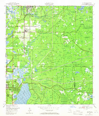
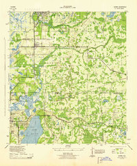
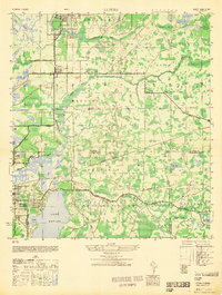
Historical Maps of Fox Hollow Through Time
6 maps found