
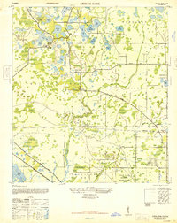
1948 Map of Elfers
USGS Topo · Published 1948About this map
New Port Richey and the unincorporated community of Elfers anchor this post-war coastal landscape where the citrus groves and swampy lowlands of Pasco County meet the Pinellas County line. The hydrology of the region is intricately mapped, showing the winding course of the Pithlachascotee River and the Anclote River as they move toward the Gulf. Distinctive local landmarks like Belchers Hole, Horseshoe Bend, and the wide expanse of Lake Butler reflect a terrain defined by limestone sinks and tidal basins. The map captures an era of evolving transit, documenting the Dixie Highway alongside older infrastructure like the Old RR Grade and the active tracks of the Seaboard Air Line. Further inland, the sparsely settled Seven Springs and numerous electoral precincts like Precinct 17 illustrate the rural political organization of the late 1940s before the massive suburban expansion of the Florida Suncoast.
Find a feature on this map
41 named features on this map. Tap any name to fly to it.
Don’t see what you’re looking for? This feature index may not catch every label — zoom into the map to look around manually.
Map Details
Editions of this 1948 Elfers Map
This is the sole edition of this map. No revisions or reprints were ever made.
Other maps of this area

1943 · Dunedin
USGS Topo · 1:31,680

1943 · Tarpon Springs
USGS Topo · 1:31,680

1943 · Odessa
USGS Topo · 1:24,000

1943 · Elfers
USGS Topo · 1:24,000

1943 · Oldsmar
USGS Topo · 1:24,000

1944 · Elfers
USGS Topo · 1:31,680

1944 · Oldsmar
USGS Topo · 1:31,680

1944 · Odessa
USGS Topo · 1:31,680
1947 · Citrus Park
USGS Topo · 1:24,000

1949 · Odessa
USGS Topo · 1:25,000