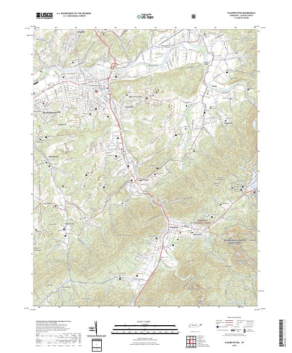
2022 Map of Elizabethton
USGS Topo · Published 2022About this map
The Watauga River and Doe River converge at Elizabethton, the seat of Carter County. This modern survey illustrates the dense settlement patterns of the river valleys, where neighborhoods like Rayon Terrace, East Side, and Fairview transition into the steep slopes of Lynn Mtn and Jenkins Mtn. To the south and east, the Cherokee National Forest protects the high ridges, including Pond Mtn and Black Mtn, where the Appalachian National Scenic Trail winds toward the shores of Watauga Lake.
Find a feature on this map
108 named features on this map. Tap any name to fly to it.
Don’t see what you’re looking for? This feature index may not catch every label — zoom into the map to look around manually.
Map Details
Editions of this 2022 Elizabethton Map
This is the sole edition of this map. No revisions or reprints were ever made.
Other maps of this area

1891 · Roan Mountain
USGS Topo · 1:125,000

1894 · Roan Mountain
USGS Topo · 1:125,000

1904 · Roan Mountain
USGS Topo · 1:125,000

1934 · White Rocks Mtn
USGS Topo · 1:24,000

1934 · Iron Mtn Gap
USGS Topo · 1:24,000

1935 · Watauga Valley
USGS Topo · 1:48,000
1935 · Carter
USGS Topo · 1:24,000

1935 · Elizabethton
USGS Topo · 1:24,000
1935 · Unicoi
USGS Topo · 1:24,000
1935 · Bluff City
USGS Topo · 1:24,000