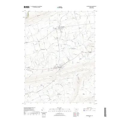
2019 Map of Elizabethville
USGS Topo · Published 2019About this map
Elizabethville serves as a central hub in this valley, situated between the prominent ridges of Berry Mtn and Mahantango Mtn. The landscape is defined by its agricultural character and the network of streams such as Wiconisco Creek and Little Wiconisco Cr that drain the central basin. Local heritage is deeply rooted in the numerous small settlements and religious landmarks dotting the countryside, including Berrysburg, Matterstown, and the Old Stone Church. The topographic detail illustrates the transition from the relatively flat valley floor to the steep, wooded slopes of Broad Mountain and Rock's Ridge. Genealogists will find particular value in the documentation of local burial grounds like Maple Grove Cem, Straws Cem, and the Forneys United Brethren in Christ Cem, reflecting the early settlement patterns of this corner of Dauphin County.
Find a feature on this map
143 named features on this map. Tap any name to fly to it.
Don’t see what you’re looking for? This feature index may not catch every label — zoom into the map to look around manually.
Map Details
Editions of this 2019 Elizabethville Map
This is the sole edition of this map. No revisions or reprints were ever made.
Other maps of this area

1892 · Lykens
USGS Topo · 1:62,500

1892 · Hummelstown
USGS Topo · 1:62,500

1892 · Harrisburg
USGS Topo · 1:62,500

1893 · Lykens
USGS Topo · 1:62,500

1893 · Millersburg
USGS Topo · 1:62,500

1899 · Harrisburg
USGS Topo · 1:62,500

1924 · Hummelstown
USGS Topo · 1:62,500

1924 · Harrisburg
USGS Topo · 1:62,500

1943 · Millersburg
USGS Topo · 1:62,500

1943 · Lykens
USGS Topo · 1:62,500
Featured Places
- Elizabethville, PA
- Wiconisco Township, PA
- Berrysburg, Mifflin Township
- Matterstown, Washington Township
- Loyalton, Washington Township