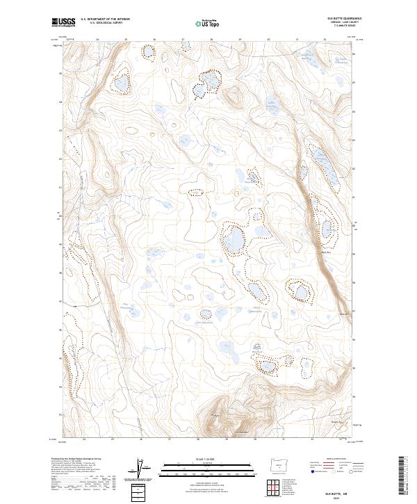
2023 Map of Elk Butte
USGS Topo · Published 2023About this map
The high desert landscape of Lake County is defined by its critical water sources and volcanic terrain in this modern survey. Named basins like Immigrant Waterhole and Spook Waterhole highlight the historical necessity of surface water for travelers and livestock in this arid region. The topography is dominated by prominent elevations such as Elk Butte and Elk Mountain in the south, while the western edge is bounded by the rise of Pine Ridge. The naming of features like Schlitz Waterhole and Bourbon Waterhole suggests a human history tied to specific campsites or local lore. Remote Bureau of Land Management routes, including BLM RD 6111-0-b0, provide the primary access through this territory of escarpments and basins, notably near the distinct verticality of Black Rim and Dragon Rock.
Find a feature on this map
23 named features on this map. Tap any name to fly to it.
Don’t see what you’re looking for? This feature index may not catch every label — zoom into the map to look around manually.
Map Details
Editions of this 2023 Elk Butte Map
This is the sole edition of this map. No revisions or reprints were ever made.
Other maps of this area

1955 · Crescent
USGS Topo · 1:250,000

1957 · Crescent
USGS Topo · 1:250,000

1958 · Crescent
USGS Topo · 1:250,000

1970 · Crescent
USGS Topo · 1:250,000
1981 · Tired Horse Butte
USGS Topo · 1:24,000

1981 · Sand Rock
USGS Topo · 1:24,000

1981 · Moonlight Butte
USGS Topo · 1:24,000

1981 · Elk Butte
USGS Topo · 1:24,000
1981 · Rams Butte
USGS Topo · 1:24,000

1981 · Chicago Valley
USGS Topo · 1:24,000